

As the PNW shifts from summer into early fall, the potential for significant weather begins to increase. Over the next 4-5 days there are three different areas of interest from a meteorological perspective:
- Lingering smoke across most of the region.
- Temperatures in the 80s-90s this weekend, with elevated wildfire danger west of the Cascades.
- Thunderstorms — isolated on Friday/Saturday and potentially widespread next Monday-Tuesday.
Smoke
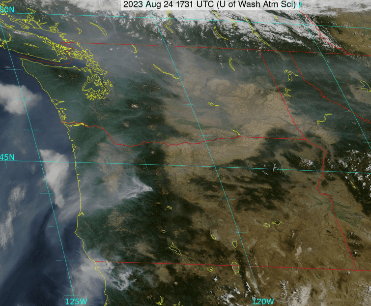
As of Thursday morning, smoke remains widespread across much of the region. Visible satellite shows that the smoke is largely diffuse except close to the source region of fires in Oregon and northern California. Ongoing fires in Washington and BC are not showing much activity at the moment.
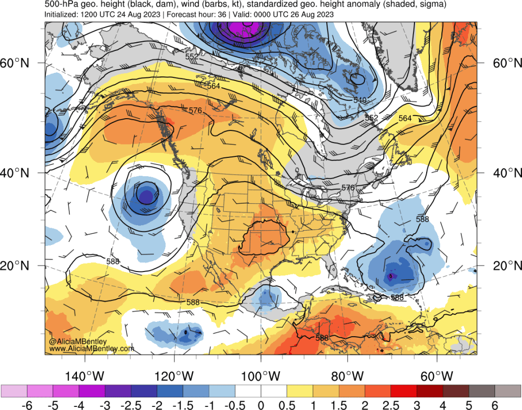
On the large scale, another area of low pressure will approach the region from the northwest and merge with an existing trough off the coast of California. Here’s the 500 hPa prediction for Friday evening:
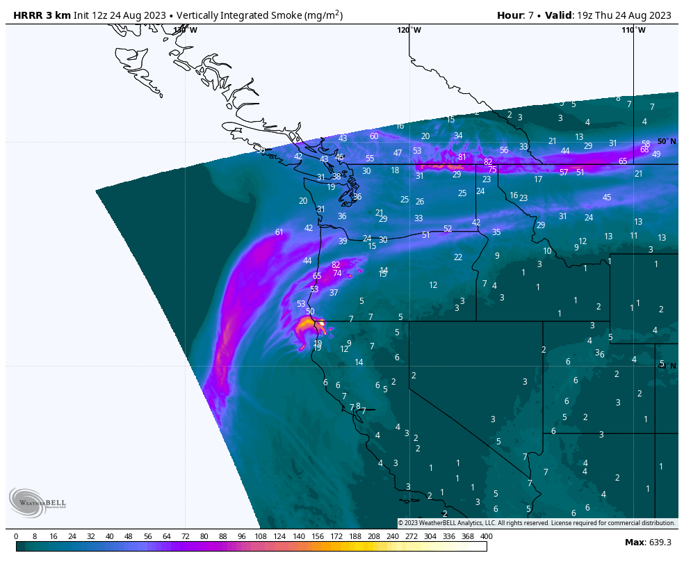
Southerly flow between low pressure to our west and high pressure to our east will draw more of the smoke from CA/OR northward into the Portland and Seattle metro areas. The latest 48-hour run of the HRRR predicts that the smoke will be diffuse enough to avoid dangerous air quality levels in most places but likely enough to drop AQIs into at least the moderate category, depending on how much of this smoke mixes down to the surface.
I prefer not to speculate on what the smoke situation might look like beyond the weekend given both the potential for fires to flare up and/or be squashed by rainfall.
Heat
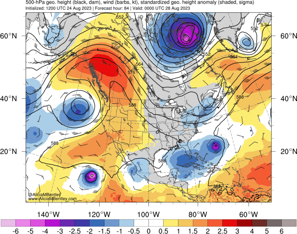
As shown in the 500 hPa map above, a broad ridge will build across western Canada and the NW Pacific by Friday evening. By Sunday evening (pictured below), the ridge is expected to intensify in amplitude, while the low pressure center should remain essentially unchanged relative to 48 hours prior.
Low pressure offshore and high pressure onshore is a setup that tends to favor easterly winds and elevated fire danger in regions west of the Cascade passes. Right now it looks like the greatest fire danger will be from today through Friday evening and largely localized to areas close to gaps in the Cascades such as the Columbia River.
In terms of temperatures, Saturday and Sunday are expected to be the warmest days, with temperatures in the upper 80s-low 90s in the lowlands west of the Cascades, with cooling in coastal areas beginning Sunday.
Thunderstorms
The western US is unseasonably moist at the present from both the remnants of Hurricane Hilary and more recently Tropical Storm Harold in Colorado.
Precipitable water is currently elevated in two areas — broadly across much of the intermountain West and along a narrow band off the coast associated with the approaching area of low pressure.

The first threat for thunderstorms will be in Oregon today, moving into Washington by Friday morning. These storms are expected to be isolated but I am concerned that lighting strikes could spark new wildfires that could quickly grow over the weekend.
A more interesting setup looms for Monday-Tuesday as low pressure is expected to approach Washington/Oregon and tap into some of the elevated moisture over the interior.
This event has the potential to bring more widespread precipitation as well as thunder and lightning. The 06 UTC ECMWF ensemble shows 40-60% probability of 0.5″ of rain or more across a large portion of western Washington for the 24 hour period ending Tuesday evening.
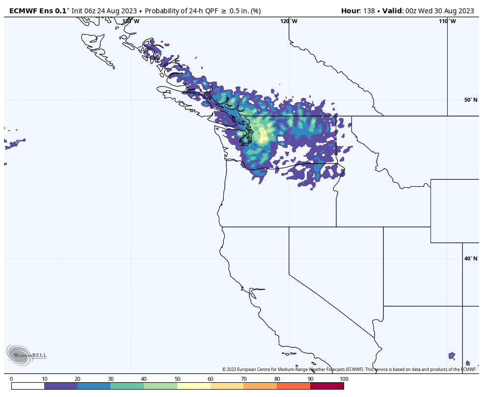
It’s too soon to say if this event will materialize into a high impact thunderstorm/rain event, especially for the Washington/BC lowlands. I think it is highly likely that thunderstorms will form over western WA, but the main action may end up being over the Cascades, rather than over the lowlands. The potential to squash wildfire risk as well as the existing wildfires in the central/north Cascades will have me crossing my fingers that future model runs continue to look encouraging.
