

The first taste of arctic air this season is expected in a few days across the PNW, bringing the first freeze of the season for many, the first accumulating snow to the mountain passes, and potentially some snow at lower elevations to the east of the Cascades.
The forecast upper-air pattern on Tuesday night shows a typical “Alaska block” setup for cold air intrusions into the PNW. This pattern places the PNW in a cold, northerly flow regime downstream of the ridge.
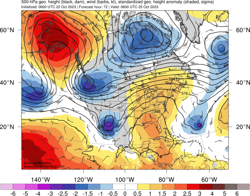
The shortwave trough depicted above (as blues and purples over the PNW) is expected to amplify over the region from Tuesday night into Wednesday. This system will bring cold air from two directions — a modified cold and moist airmass from the Pacific Ocean and an even colder continental airmass from interior British Columbia and Alberta.

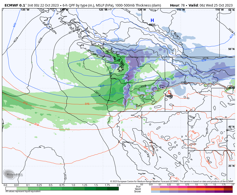
Tuesday afternoon and evening are expected to be wet across much of the region with snow levels below pass level in the Cascades. Unlike some of our recent mild storms that featured lowland rain with temperatures in the upper 50s or low 60s, this will feel more like a winter storm with temperatures dropping into the 40s by early Wednesday.
As of right now, it looks like the cold air will stick around for the entire week, with a second, weaker storm on Thursday expected to bring a reinforcing shot of cold air and more light rain in the lowlands and snow in the mountains.
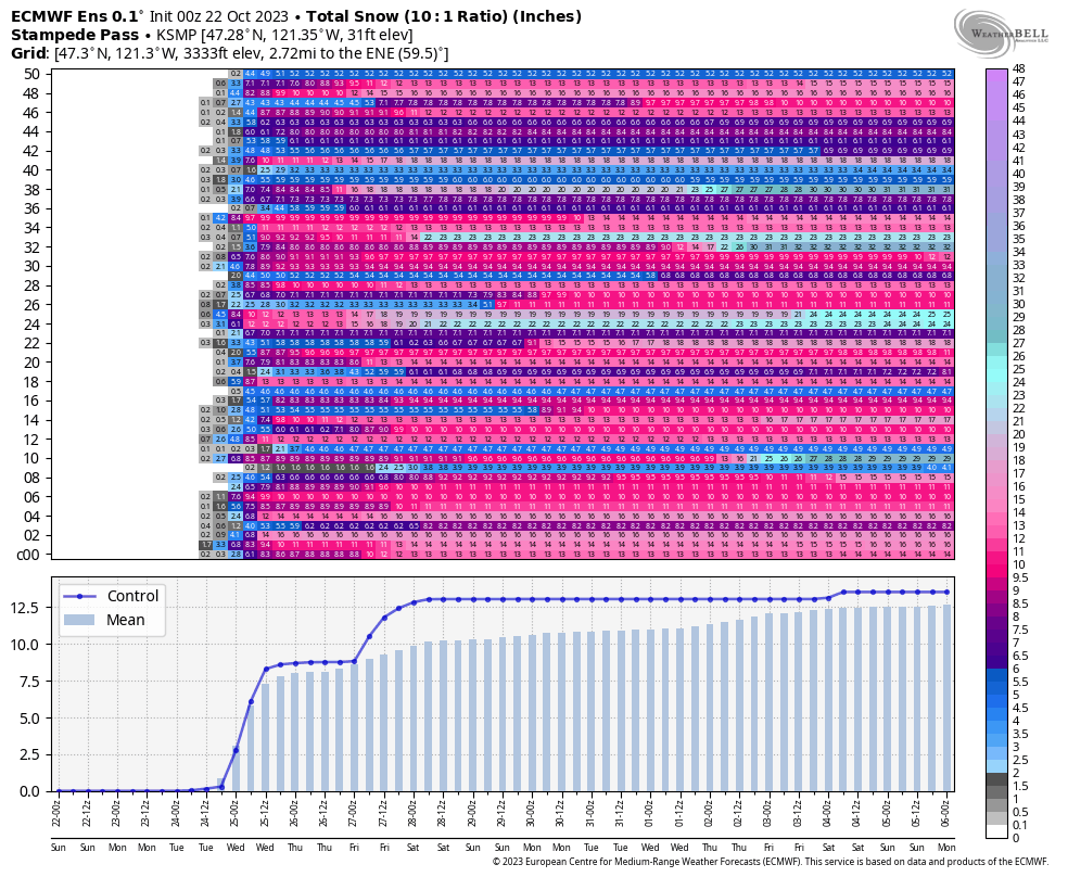
The ECMWF ensemble suggests that 6 or more inches of snow is fairly likely at Stampede / Snoqualmie Passes on Tuesday night with a lesser chance of additional snow later in the week.
If it was late November instead of late October, I would say that the second system would pose a threat for lowland snow east of the Cascades. Unfortunately, while this approaching airmass is anomalous for late October, it’s not especially cold relative to winter standards and the main surge of the coldest air appears to be aimed at Montana.
More opportunities for cold in November?
Most seasonal forecasts are predicting a mild and relatively dry winter across the PNW given the ongoing El Niño in addition to the Pacific Decadal Oscillation (PDO) transitioning away from the negative (cold) phase that has been present for the past few winters.
However, the current state of the tropics (the Madden-Julian Oscillation in particular) suggests that the Rossby Wave pattern over the northern hemisphere may continue to favor a large scale trough over western North America in November. As winter progresses, warmer and drier weather on average across the PNW appears to be more likely.
