

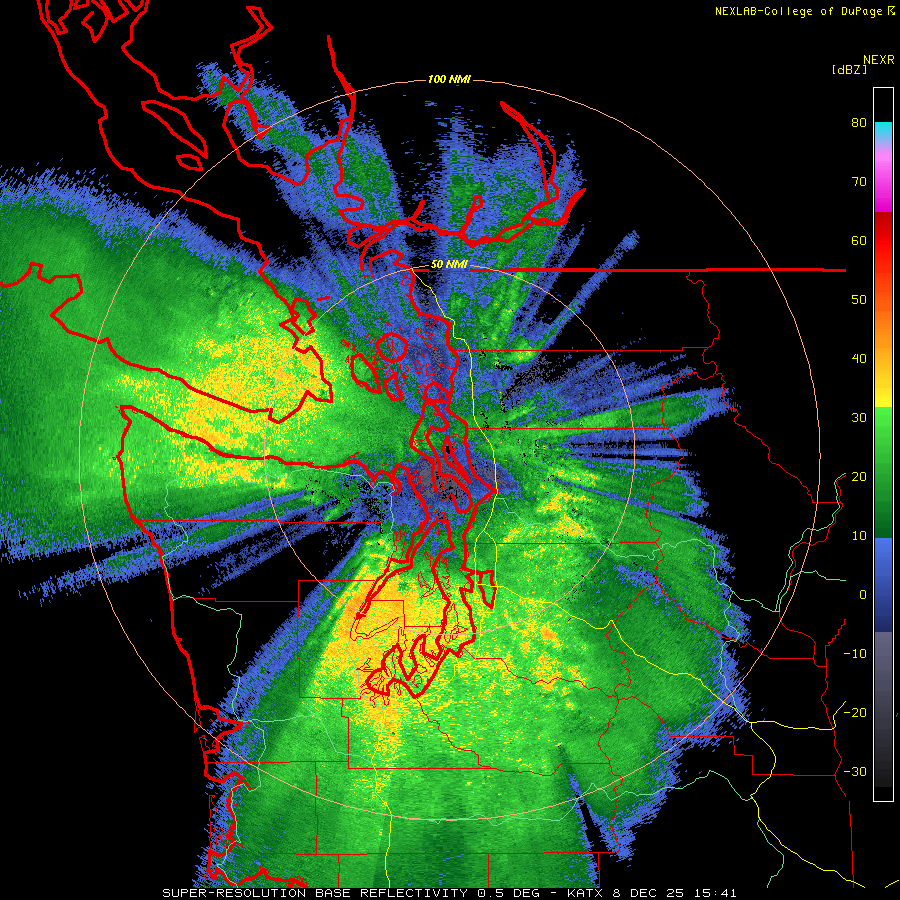
The “main event” is now underway in the PNW as radar on Monday morning shows broad coverage of light to moderate rain. Here’s the Langley (coastal WA) radar:
The enhancement of the radar echoes as they move over terrain is clearly evident in this image. The moisture plume in atmospheric rivers is located fairly low in the atmosphere so it’s easy to generate additional precipitation over smaller foothills.
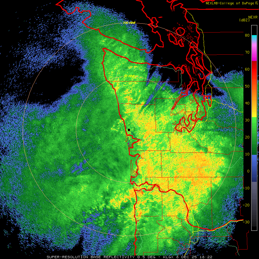
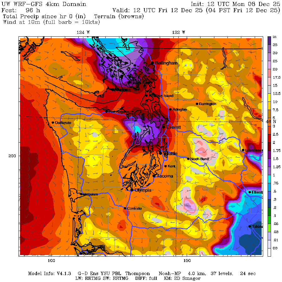
Radar over Puget Sound shows a profound rain shadow extending from Sequim into Snohomish County.
Mesoscale models have been showing this as one of the strongest rain shadows in recent memory. Less than a quarter inch of rain will fall in the center of the rain shadow through Wednesday morning. Seattle is right in the strongest gradient, with around 2 inches possible at the southern end of the city near White Center and maybe 0.75″ on the north end of the city near Shoreline.
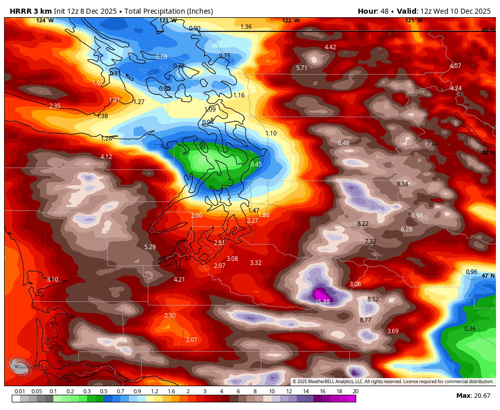
The above image only shows the totals for round one — additional rain of nearly the same magnitude will fall on Wednesday into Thursday.
One of the main reasons for the strong rainshadowing is the consistency of the west-southwesterly moisture fetch across a huge chunk of the Pacific Ocean.
With the fetch maintaining strong flow in a consistent direction, the rain shadow will not move around much.
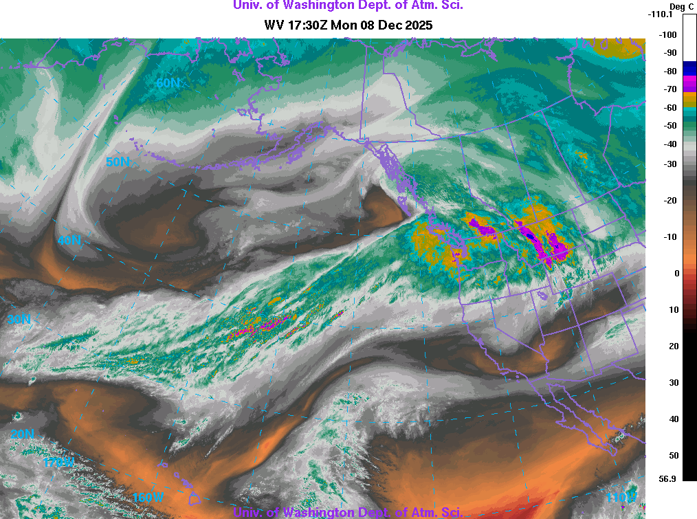
Here’s the integrated vapor transport (IVT) forecast for Monday evening. IVT is a “flux” parameter that is basically a measure of how much water vapor the atmospheric river is advecting horizontally.
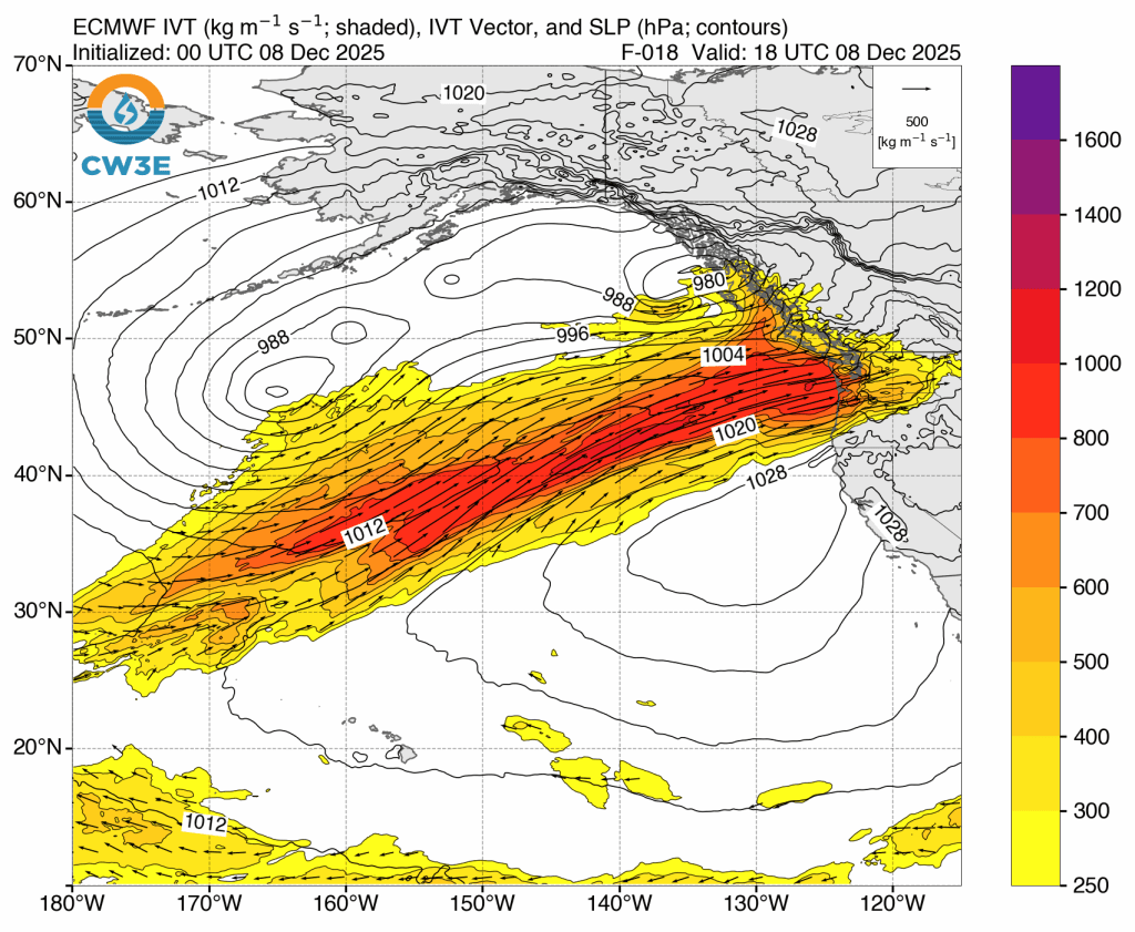
Along there is a single moisture stream, you can see there are two separate areas of low pressure to the north of the IVT channel. Low pressure systems act to consolidate and accelerate the moisture transport, giving us a two-part event.
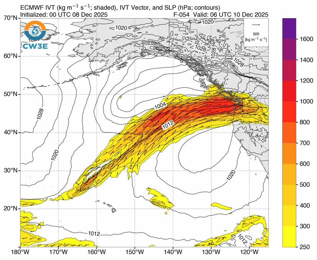
After a brief lull on Tuesday, round 2 on Wednesday looks similar. Here’s the IVT forecast for late Wednesday evening. The second round looks to be a tad north of the first and maybe have a bit more of a westerly orientation.
Total precipitation through Thursday night will be impressive (note that the ECMWF model is likely underestimating the strength of the rain shadow). Nearly 4 inches at Sea-Tac airport, over 5 inches in Portland, and over a foot of rain in the mountains.
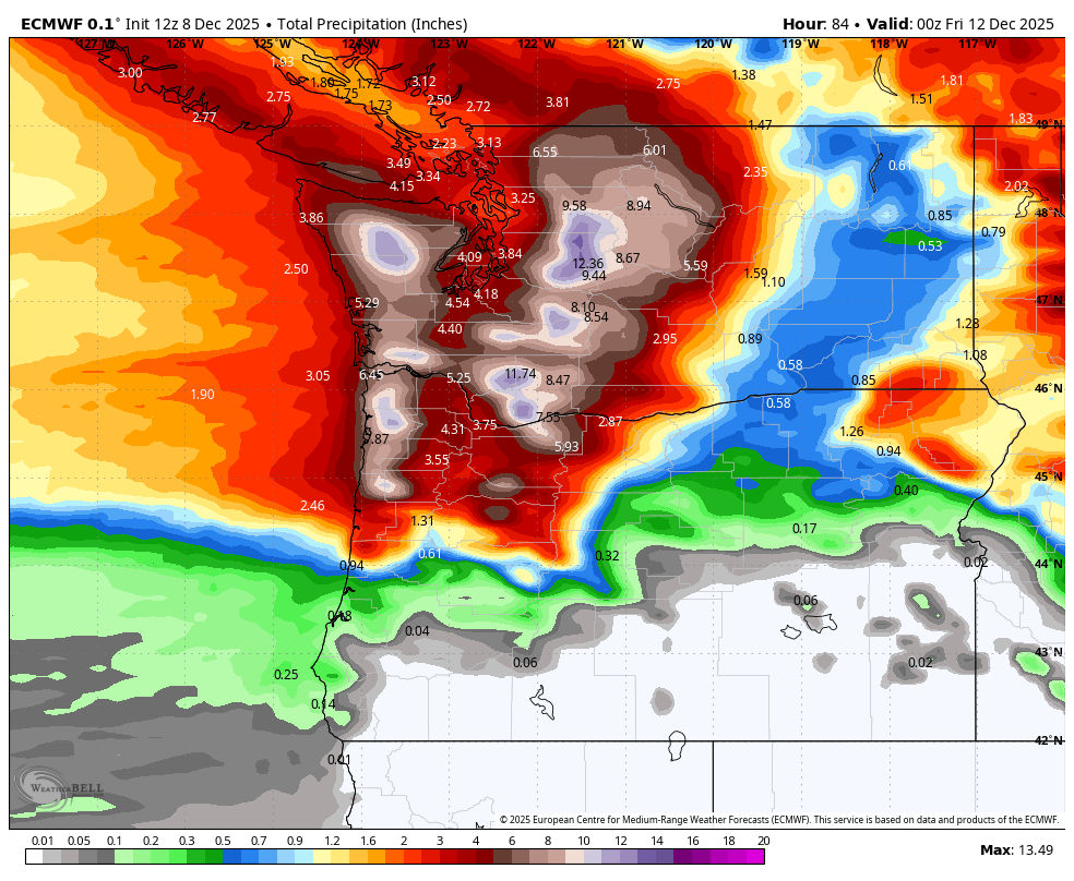
The higher resolution UW-WRF model (4 km) suggests that the totals in favored parts of the mountains could approach 2 feet. Snow levels will generally be over 7,000 feet so this will mostly be rain.
Not surprisingly, a major flood is predicted at most of the major rivers in the central and southern Washington Cascades.
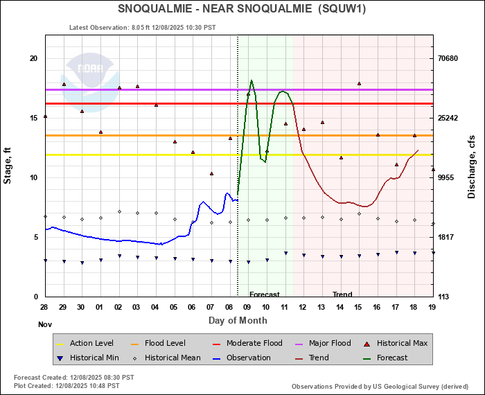
Snoqualmie River:
Cowlitz:

In past events, the worst impacts of strong atmospheric rivers tend to be confined to 1-2 river basins where the center of the moisture flux spends the longest time. The worst case scenario in this event would be if both part 1 and part 2 are centered on the same river basin. If that happens, we could see water levels exceeding these forecasts.
Mountain snow next week?
After a brief break at the end of the week, it looks like active weather will resume by Sunday or Monday of need week. It appears that snow levels might finally be low enough to get some accumulation at Washington ski resorts.

Another excellent weather overview and analysis. I have so missed your postings!!
LikeLike