

We’ve finally reached the winter solstice but winter weather has been hard to come by. Much of the continental US is about to become trapped in a record breaking “omega block” patter that will bring record or near-record warmth to a large portion of the country just in time for Christmas.
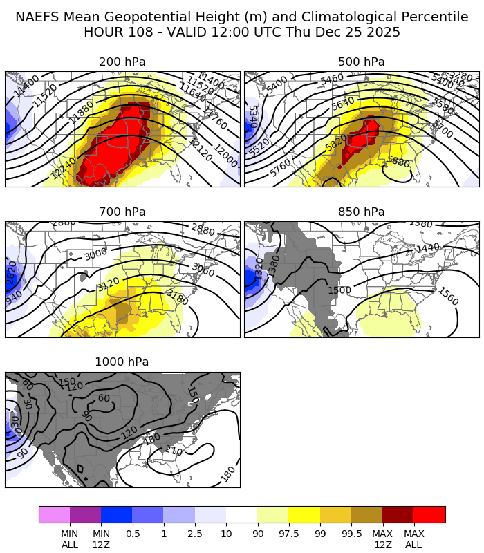
The classic manifestation of an omega block is an L-H-L pattern in the upper level flow with the height contours following an Ω shape.

In terms of anomalies, the center of the ridge at upper levels (200 hPa, 500 hPa) will be the highest on record at this time of year over the central US.
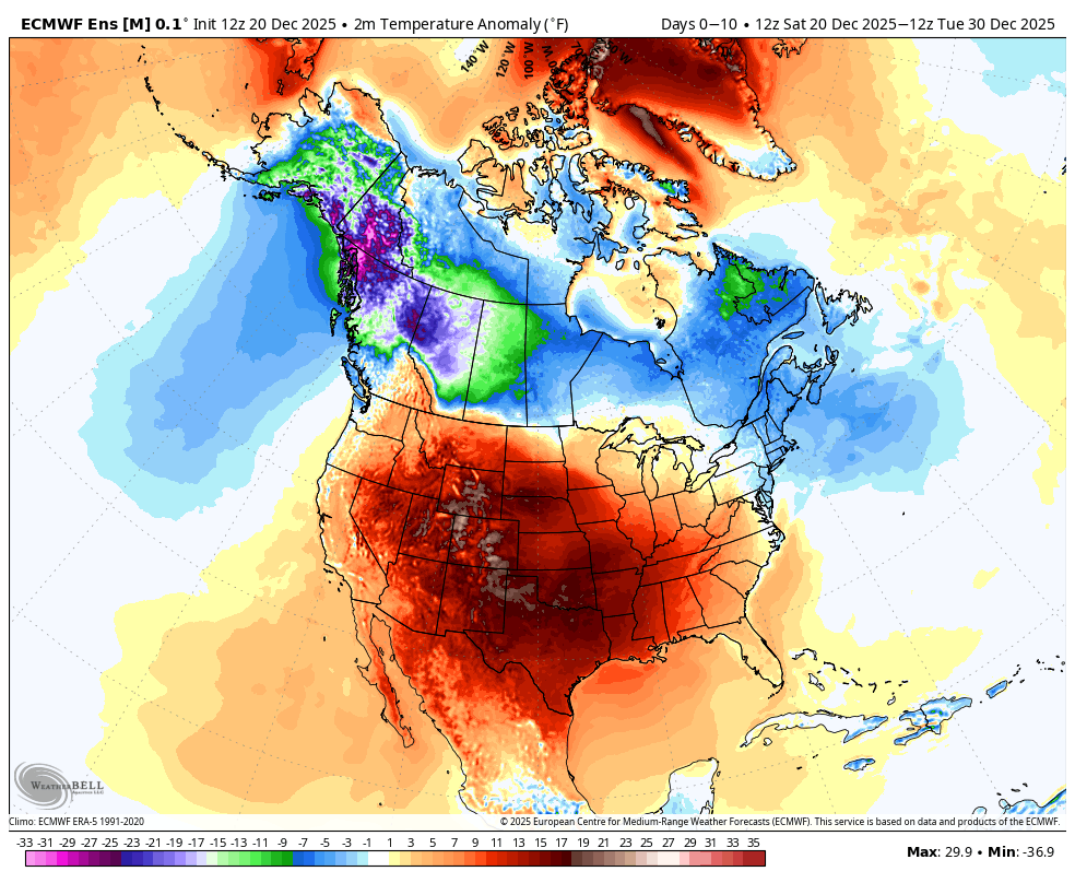
Surface temperatures will exceed 30°F above normal in the central US on Christmas. Western Washington is one of the few spots in the continental US that will actually be near or below normal.

In terms of actual high temperatures on Christmas, highs in the 70s will be widespread as far north as Kansas and Missouri.

Persistent warmth
Omega blocks are notoriously persistent and this one will be no exception. Here’s the 10-day surface temperature anomaly forecast (ECMWF ensemble) covering December 20-30.
And here’s the last 5 days of the most recent ECMWF run covering January 1-5. Still warm.

Wet and stormy west coast
One notable exception to the above torching is the west coast of North America. The longwave trough off the west coast of the US will continue to send weather systems onshore for the foreseeable future.
The good news is that the bulk of the atmospheric river action will shift southward to California, while Washington and Oregon will remain active but with lower snow levels. The precipitation forecast for the next week shows only about 1-1.5 inches in Seattle and Portland.
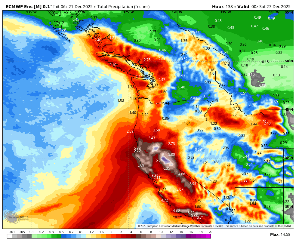
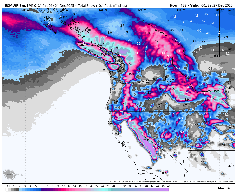
Snowfall over the same period will be most impressive in the Sierras. Farther north there will be enough snow to finally get some ski resorts open.
Christmas eve windstorm in Oregon?
The most intriguing and potentially dangerous feature in this period is a forecasted ~980 mb low pressure system that some models show approaching the southern Oregon/northern California coast on Christmas Eve. Here is the latest depiction in the European model at 4 AM on the 24th:
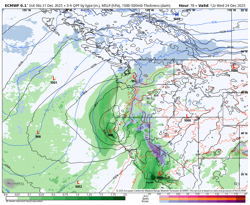
If the European model is correct, the low will move rapidly northward and be over the Olympic Peninsula in Washington State by the afternoon with a tight pressure gradient trailing to the south.
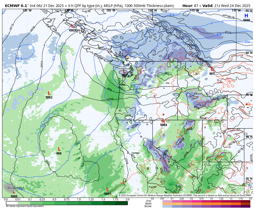
Historically, low pressure centers with this track and intensity have produced strong winds in the Willamette Valley. So it is not surprising to see some high end wind gusts in the ECMWF forecast.
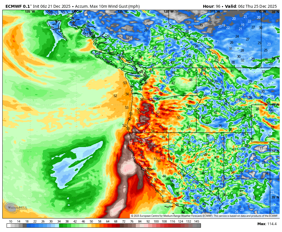
What is the likelihood of such an event occurring? The ECMWF ensemble maximum wind gusts for Portland (PDX) suggest that it’s about 50/50. Many of the ensemble members show almost no wind at all, suggesting high forecast uncertainty.
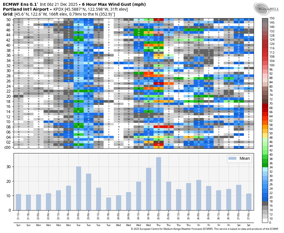
The GFS ensemble shows no indication whatsoever of the potential for a serious event in Portland. Not a single member has strong winds. Unfortunately, the inability to convey true uncertainty makes the GEFS completely useless at best and dangerous at worst for extreme event forecasting in this scenario. Perhaps there will end up being no wind at all, but at the current time there is clearly at least some risk of a decent windstorm.
Lowland snow in western Washington appears unlikely
On Friday I mentioned the potential for lowland snow in Washington around Christmas as some models had shown the aforementioned low pressure system taking a favorable track for snow.
Unfortunately for snow fans, it appears there simply isn’t enough cold air in place to bring the snow level below 1,000 ft, even if the low would take a perfect track. Some of the more favorable tracks could potentially lead to snowflakes at higher elevations and closer to the Canadian border, but lowlands and lower foothills are going to be stuck with rain for Christmas it appears.
It still appears possible that colder air over northern BC will eventually get pulled southward in early January, but it remains too early to tell.
