

On the large scale, the past week in the Pacific Northwest has featured stagnant weather with relatively light winds and generally clear conditions aloft. However, on the local scale conditions have been far more variable, with a number of interesting temperature and cloud patterns that are worth a closer look. As the title of this post suggests, most of what I will describe can be blamed on a persistent inversion.
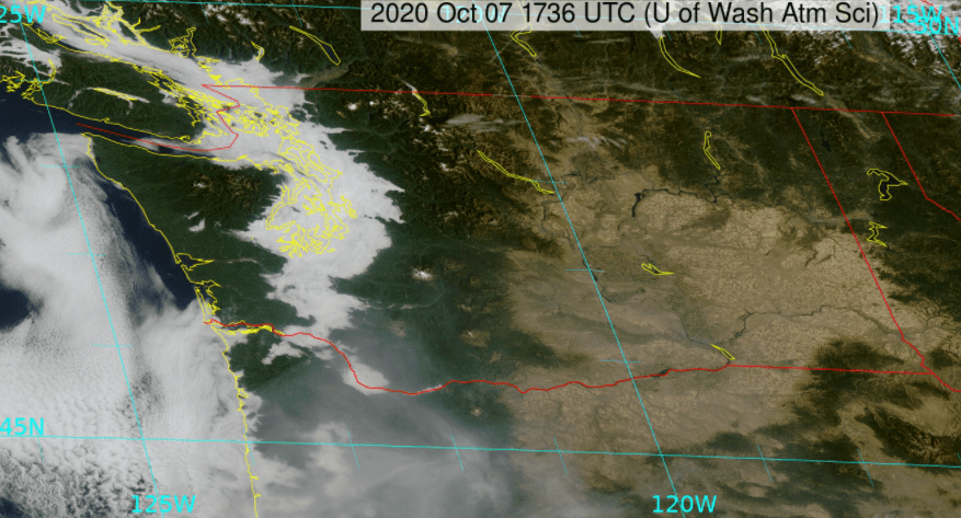
The first feature of note is low clouds and fog in western Washington, which have generally formed in the overnight hours and burned off in the afternoon. Here’s a satellite image from 10:30 AM Wednesday 10/7.
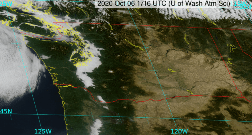
Most of the past week has looked the same. Here’s Tuesday 10/6, again around 10:30 AM.
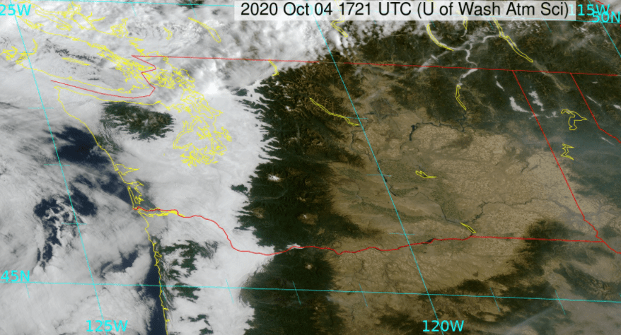
Sunday morning had more widespread low clouds, thick enough to produce drizzle in some places.
What’s going on?
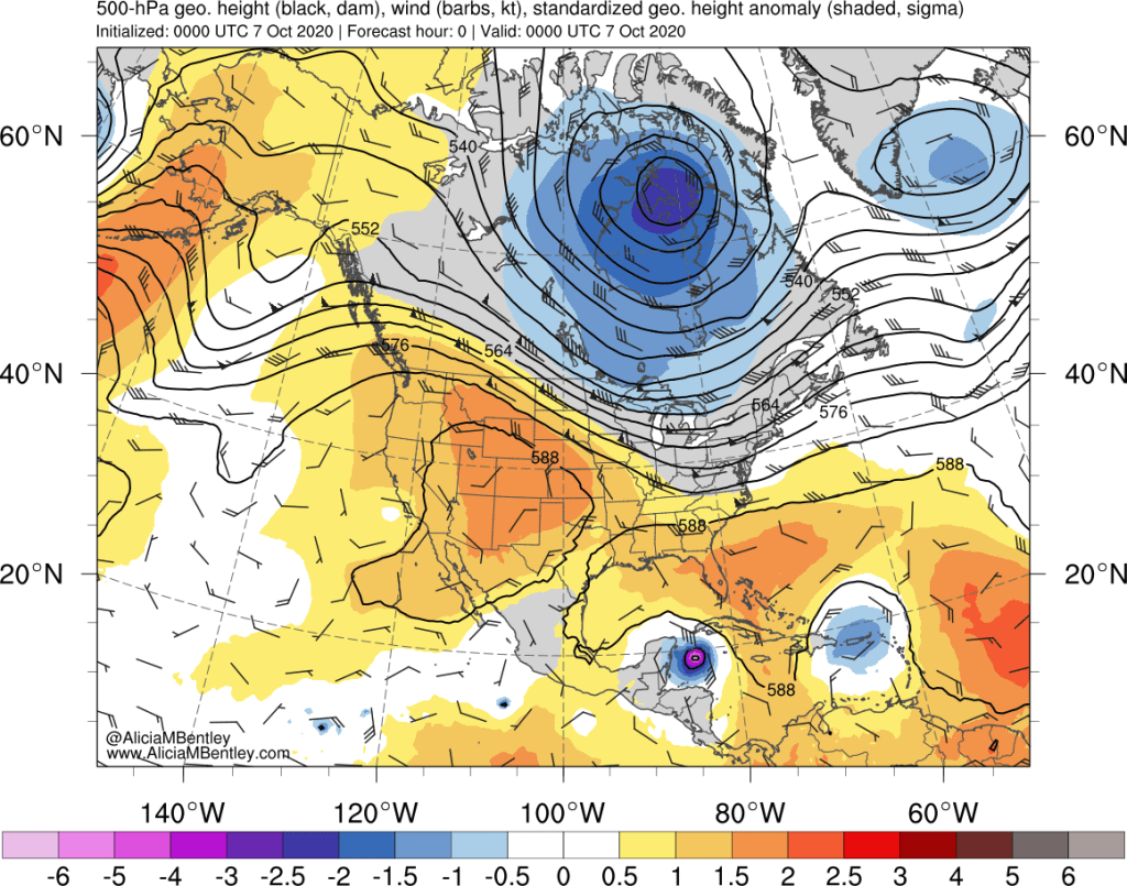
On the large scale, persistent ridging was in place across the west coast. This has been largely the case for the past week. Temperatures aloft were well above normal.
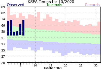
However, this warmth aloft has not always translated to warm temperatures at the surface. The observed high/low temperatures for Sea-Tac airport show that 4 out of the first 6 days in October have experienced high temperatures well above normal and the other 2 days were well below normal. The low temperature has been above normal all 6 days.
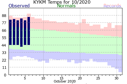
On the east side of the Cascades, the heat is on. Yakima has been in the 80s every day this month with almost no variability.
Clearly the fog/stratus is to blame for greater day-to-day variability in Seattle. But why are the stratus clouds so variable? And why are there only clouds on the west side of the Cascades and not the east side?
To dig a little deeper, lets take a look at the vertical profiles of temperature and dew point from weather balloons launched at Quillayute (on the Olympic coast) and Spokane from Sunday morning and evening (one of the days that the clouds stuck around all day in western WA). The red line is temperature and the dashed blue line is dew point.
First, here’s Quillayute. Focus your attention on the lowest part of the atmosphere, below 850 hPa (about 5,000 ft elevation).
On Sunday morning (above), these was a saturated layer near the surface (temperature = dew point) meaning clouds/fog were present. At the top of that layer was an inversion, where temperature increased with height. This is a fairly significant inversion with a ~5 degree Celsius increase over a small vertical area.

On Sunday evening, the cloud layer had mixed out somewhat but the persistent inversion was still there at Quillayute.
Now lets look at Spokane in eastern Washington:
Spokane had a very strong surface inversion on Sunday morning. It was 5.9 C (43 F) at the surface and 18.1 C (65 F) only 200 meters above the surface! That’s a change of over 20 degrees F in a vertical distance of approximately the height of the Space Needle!
Warm air on top of cold air is a stable situation that resists vertical mixing (think of oil + water). But that didn’t stop the inversion from disappearing entirely by Sunday evening:
Because there were no clouds in eastern WA, the sun heating the ground surface allowed the inversion to mix out. In western WA, the low clouds/fog prevented most of the sun’s energy from reaching the surface. As the sun angle lowers in autumn it gets increasingly difficult to mix out these inversions.
Why no clouds in eastern WA? Eastern Washington is no stranger to strong inversions, but they often have fog associated with them in the winter months. So far this fall there has been no significant rainfall east of the Cascades, so there is not enough moisture to generate any low clouds. In western WA, stagnant air masses are more prone to quickly build up moisture under an inversion, especially after a recent rainy period.
Moisture is not the only thing that builds up under inversions, pollutants build up as well:
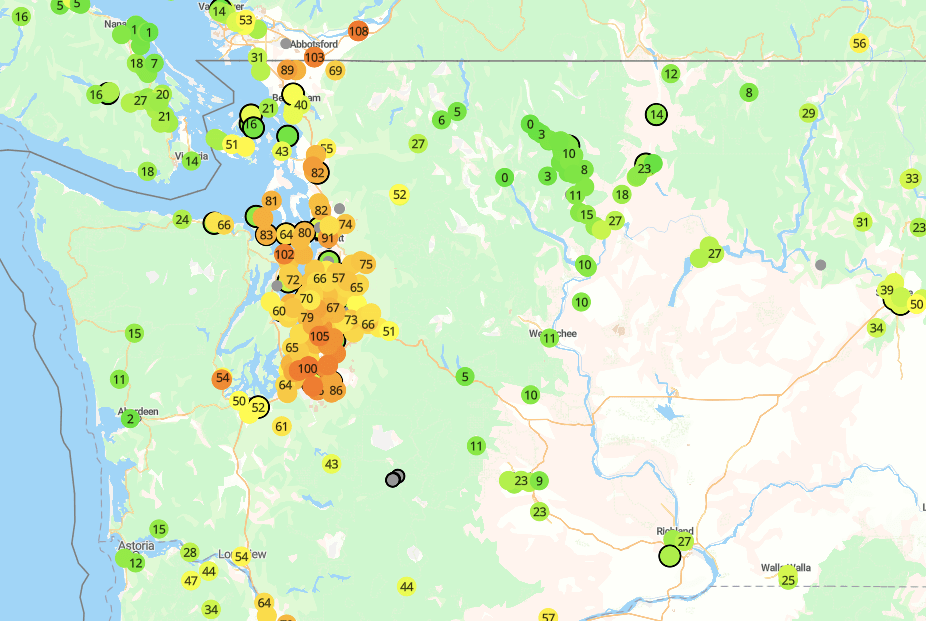
As of Wednesday evening, the air quality was generally in the moderate range in Puget Sound, but cleaner elsewhere where more mixing (or marine air) was occurring. The poor air is likely a combination of remnant wildfire smoke and local pollution.
One last interesting feature of the inversions was pointed out to me by my AgWeatherNet colleague, meteorologist Craig Oswald. The AgWeather net low temperature map for Monday morning around Yakima featured some really fascinating local variability:
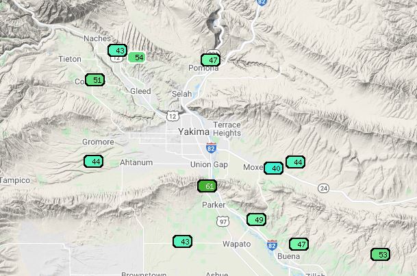
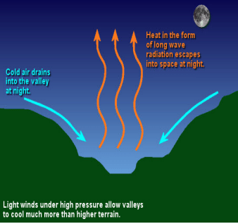
What’s going on here? On calm, clear nights, cold air drains down to the valley floor. Tree fruit growers in the area are well aware of this phenomenon. The strength of the inversion can easily be seen by comparing the low temperatures on the valley floor (low 40s) to the ridges (low 50s).
However, that still doesn’t explain the low of 61 at the lower-elevation Parker station just to the south of Union Gap. Lets take a closer look at the 15-min observations:

Strong northerly winds were present for much of the night, up to 14 mph sustained. Meanwhile, at the Moxee site that dropped to 40 F on the valley floor, the wind hovered around 2-3 mph all night.
The University of Washington 1.33 km WRF model is capable of picking up some of these drainage flow features.
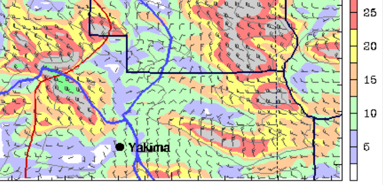
Strong northerlies were predicted near Union Gap (bottom of image south of Yakima) as well as strong northwesterly flow near Naches to the NW of Yakima. Presumably the wind further accelerates through the narrow Union Gap, which is too small of a feature to be resolved by even the highest resolution weather models currently available.
That said, the ability of high resolution models to resolve many of these fine-scale features suggests potential for better temperature predictability during these events. My research at AgWeatherNet is focused in part on developing these forecast products. It is a tricky problem because the drainage flow is slightly different every night depending on a number of larger-scale variables such as clouds and humidity.
As for getting rid of that persistent inversion, a transition to stormy weather is currently underway and air quality has already improved across western Washington as of Thursday morning.

Thankss for writing this
LikeLike