

Forecasters are dealing with a tricky scenario over the next day as a potential windstorm with high forecast uncertainty takes aim at the PNW.
As of Tuesday morning, NWS Seattle has high wind watches in effect for both the coast and interior portions of western Washington. Much of western Oregon is under a wind advisory.

The setup for this event is a rapidly deepening low pressure center off the coast of California. The developing low pressure center (black contours) will be in a favorable position relative to the jet stream this evening. A “jet streak” of faster winds at upper levels (pink colors) can be seen rounding the base of the deep trough off the west coast of the US in the image below.

The above is a common setup for rapid cyclogenesis, but usually this occurs farther to the north and west over the open Pacific. Having a strong low form close to shore presents a much greater risk of strong winds.
Once the low forms, it is expected to move north or north-northeast in the general direction of the Olympic Peninsula.
Forecasters basically have three pieces of uncertainty here:
- Strength of low
- Track of low
- Potential formation of a sting jet feature
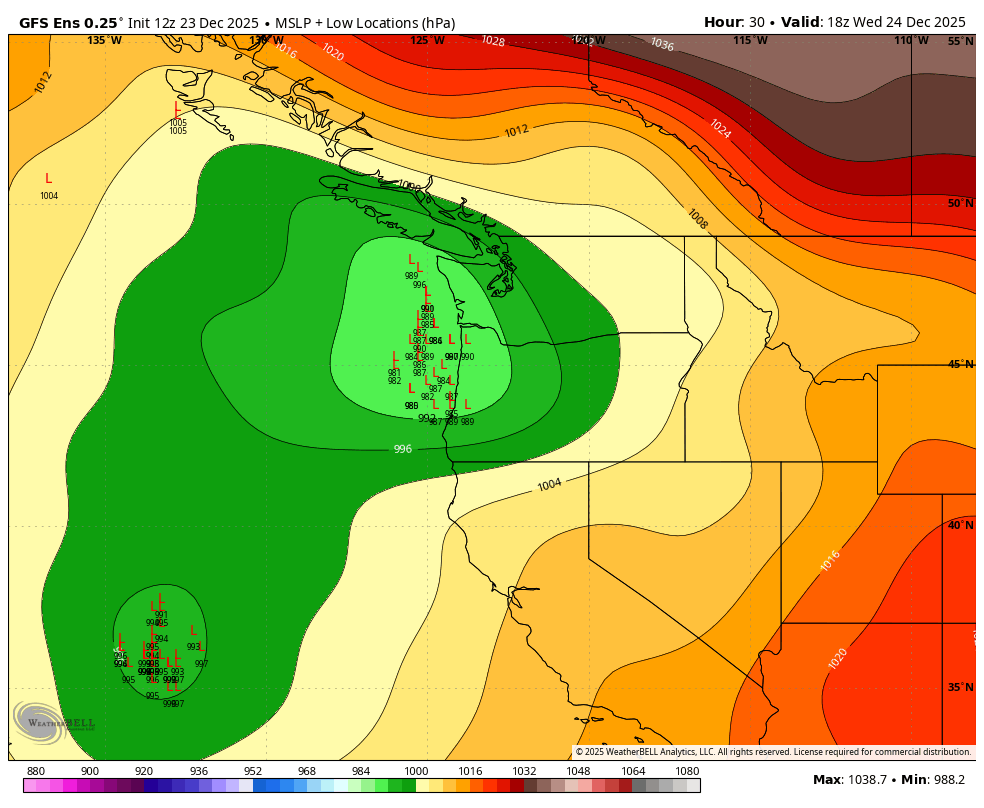
Models have been all over the place with this event over the past few days. As of Tuesday morning, the European model and GFS generally fall into two separate camps. The European model is generally weaker and more inland with the low center. In the image below, each “L” is an individual ensemble member low center and the contours are the average surface pressure across all ensemble members for 10 AM Wednesday morning.

In contrast, the GFS ensembles show a deeper low located farther west.
The worst case scenario is a deeper low (minimum pressure of 985 hPa or below) that tracks close to the coast or inland. Both the GFS and ECMWF ensembles show a few members with these stronger scenarios. Here is the max 10 meter wind at Sea-Tac across all of the ensemble members. Each row is one ensemble member, or one possible scenario for how this might unfold. The key is to look for the orange/red colors near the left side of the plot, which are the stronger scenarios.

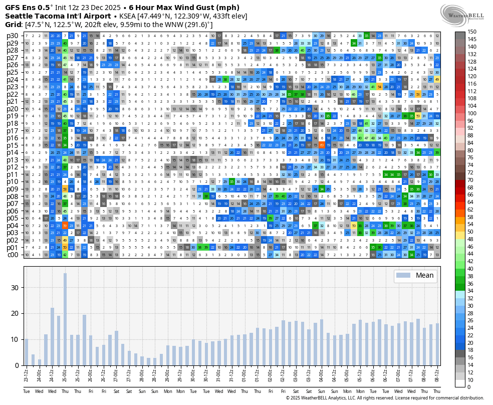
Around 10-20% of the ensemble members show a significant wind storm in Seattle. Around half show at least a moderate wind storm with maximum gusts exceeding 40 mph.
What about the higher resolution models?
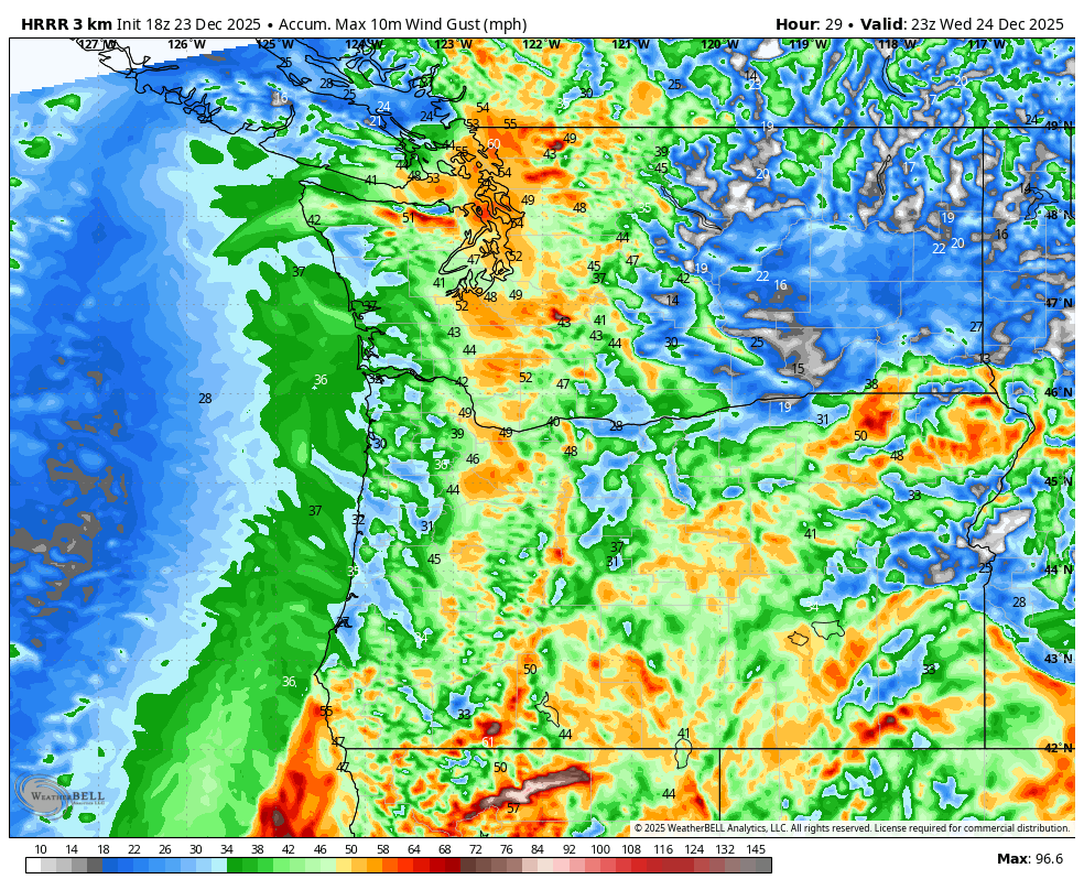
The latest HRRR model shows maximum winds over 45-50 mph across much of the interior of western Washington and Oregon.
The latest UW-WRF looks similar — strongest winds over the north Sound and San Juans, but still a moderate event in the Seattle area (40-50 mph max gust). Note that the UW-WRF winds are in knots.

The UW-WRF scenario above is for the case with a fairly deep low pressure center (~980 hPa) but remaining offshore.
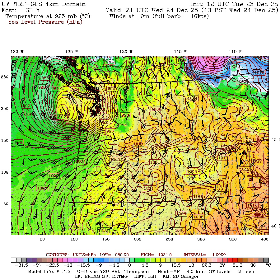
The sting jet on the southern side of the low pressure center would be quite impactful for the coast as well as some of the higher terrain areas inland. The dark blue colors below are for wind gusts around 60 mph.
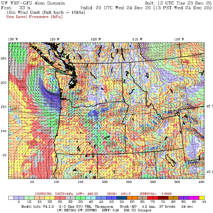
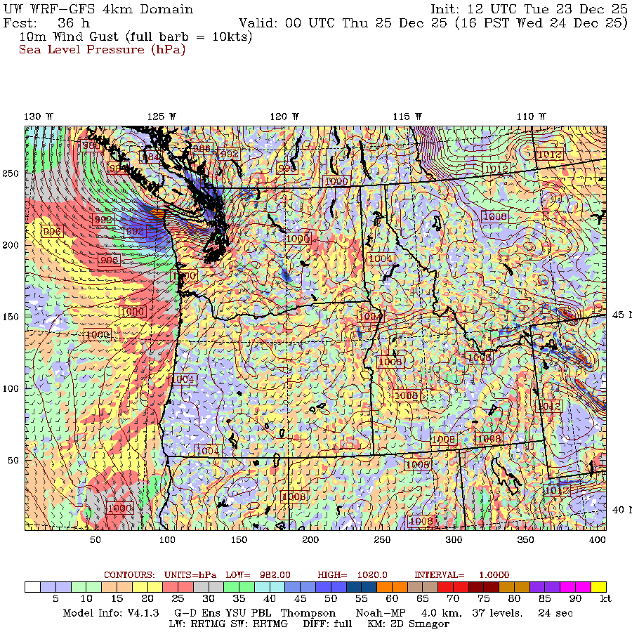
Here’s the next timestamp (valid 1-4 PM Wednesday) showing the peak of the event in western Washington.
Prognosis
Clearly there is a threat worth taking seriously based on the above model forecasts and especially the stronger winds shown in the high resolution models.
I honestly have no idea if this will end up being a major event or not, but given all of the recent rainfall, it won’t take much to topple trees and cause power outages. I recommend preparing for widespread and extended power outages. Hopefully it ends up being a weak breeze.
Finally, make sure to thank the first responders and utility workers who might have to be on duty over the holidays cleaning up from this storm.

It’s looking like the potential for strong winds is higher over NW WA. What do you think we can expect in the Bellingham area?
LikeLike
Looks like the NWS has canceled all high wind alerts for the area. So far, there has been almost nothing going on here in Bellingham. There were northerly gusts in the mid-20’s this morning, but it has been close to calm since about 8:30am. The barometer got fairly low at around 9 am, but has been steadily rising since then. As of now (3 pm) very little is going on. This looks like a pretty big miss. A lot of very smart people expressed a lot of concern about a high wind event. I guess it shows the power of random events and the difficulty of weather forecasting. Not sure if everyone has gotten gun shy since the severe weather earlier in Washington.
LikeLike
Looks like a big fizzle here in Bellingham.
LikeLike