

A few weeks ago, it looked like cold and snow may have been finished for the winter, but longer range models held out a bit of hope for one last wintery period around the final week of February. Those projections turned out to be correct, as the PNW is currently experiencing a brief but potent Arctic air intrusion.
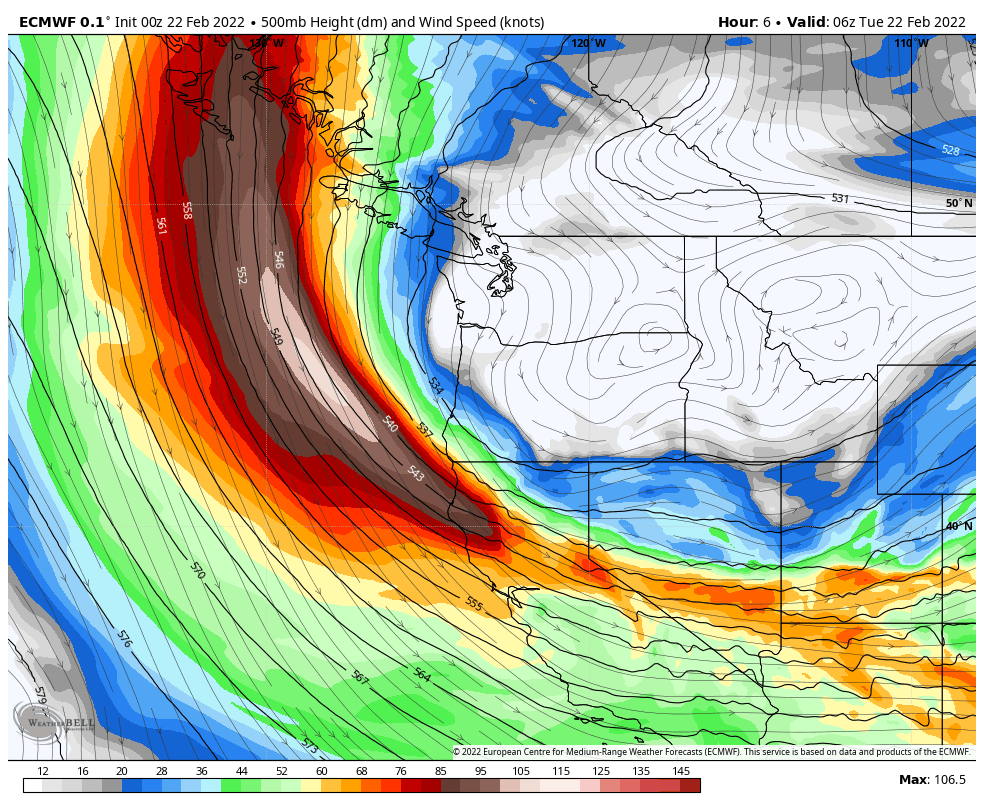
The large-scale setup for this cold snap is an interesting one. The “west coast ridge” has continued to maintain a stranglehold on our weather, with storm systems forced to ride over the ridge and approach us from the north or northwest.
As luck would have it, one of the upper-level disturbances approaching from the north was able to tap into some colder air over northern Canada as it dug southward over the western US. The ridge axis has also shifted offshore to around 140 °W longitude.
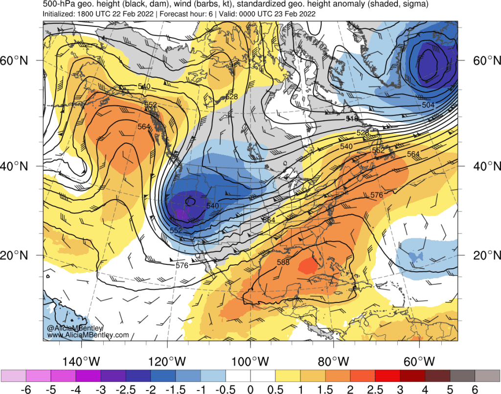
The 850 hPa temperature anomalies are impressive, 3-5 standard deviations below normal. In absolute numbers, the 850 temperature at Quillayute was -9.5 °C on Tuesday evening, the coldest reading of the winter outside of the late December cold period. Historically, the coldest Quillayute gets at this time of year at 850 hPa is around -10 to -11 °C.
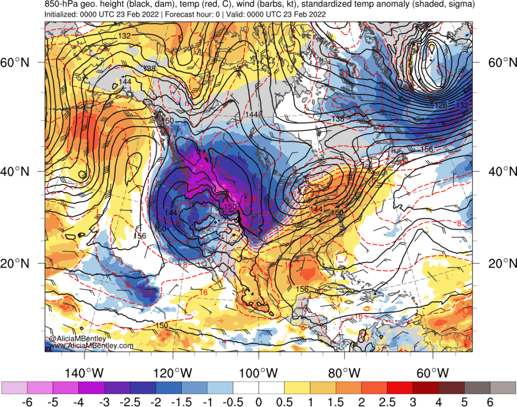
The speed and efficiency of the cold air intrusion has been a big part of the story with the evolution of this trough. The Fraser outflow has been particularly impressive.
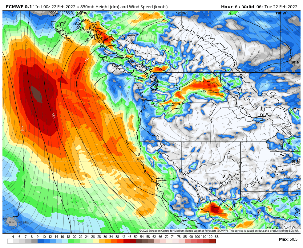
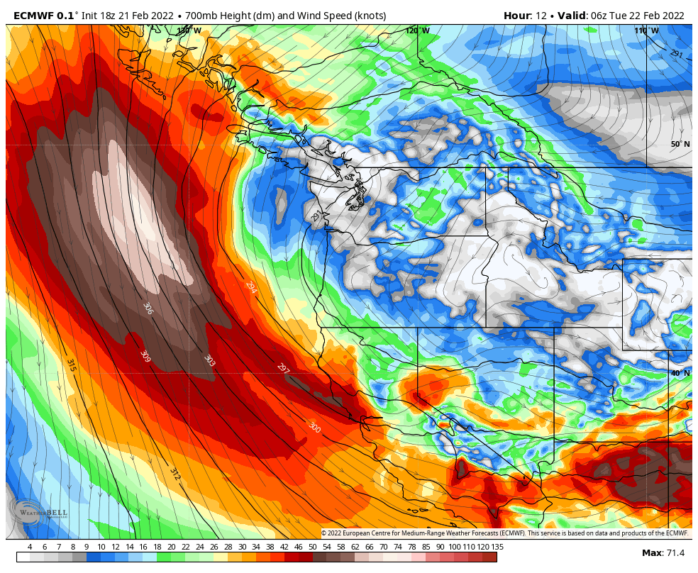
Another interesting aspect of this event are the winds at mid- and upper-levels. As the trough amplified and dug toward the southwest US from Monday afternoon into Monday night, the steering flow “backed” from the east to northeast to north between 850 and 500 hPa.
At 850 hPa (~5,000 ft), the flow was straight from the east over Washington State on Monday evening:
A bit higher up, at 700 hPa, it was weaker and from the northeast:
And at 500 hPa, the flow was close to zero, with a weak northerly component.
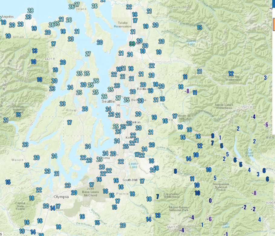
The combination of weak steering currents and strong gap winds allowed for low-level convergence to persist in some unusual locations.
The first interesting event happened on Monday morning, prior to the above time. A band of precipitation associated with the initial Arctic front stalled over Camano Island, leading to a narrow area of 6-8″ of snowfall. It appeared that a mesoscale low pressure area along the front contributed to the surprise event as well.
On Monday afternoon, a convergence zone formed on southwest side of the Olympic Mountains as the Arctic air continued to push south and westward.
Finally, on Monday evening, snow showers developed over the central Sound, including the Seattle area. An inch or two of snow was observed in many areas. These snow showers formed along the cold air moving east to west through the Cascade passes.
With weak steering currents at mid- and upper-levels, the lower-level flows continued to dominate through Tuesday morning, with snow showers continuing to form along a weak but broad area of convergence over the central and north Sound.
Overall, it was a nice change of pace after the boring weather that has largely dominated since mid-January, and the snow was light enough to keep travel impacts minimal for the most part.
Record low temperatures
Low dew points and clearing skies allowed the temperatures west of the Cascades to plunge from late Tuesday into Wednesday morning. Minimum temperatures were in the upper teens to mid-20s in the lowlands. The low of 23°F at Sea-Tac broke the daily record, set just four years ago in 2018.
It was really cold in the mountains — below zero in a few spots.
More snow on Wednesday night into Thursday?
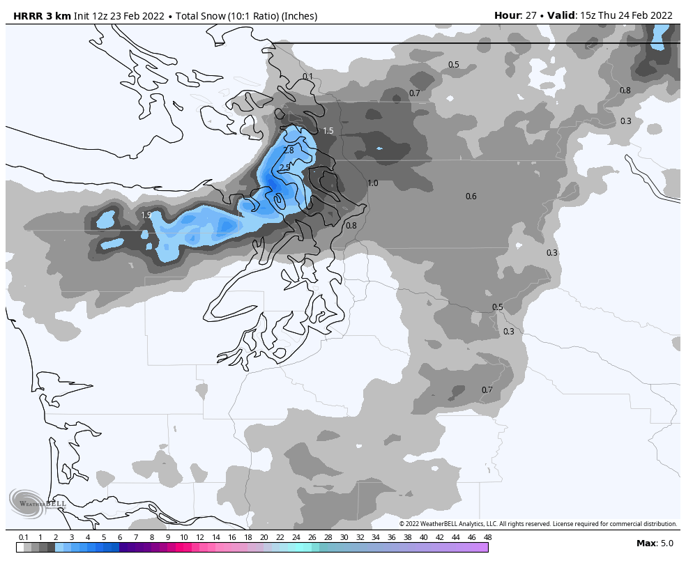
There will be one more opportunity for snow before the cold air makes a quick exit on Friday as a weak upper-level disturbance drops down from the north. Mesoscale models including the HRRR (pictured below) and UW-WRF are showing up to 2-3 inches of snow around Sequim, and Whidbey Island. Seattle may see some flurries or a dusting but is unlikely to see measurable snow.
Lowland rain/mountain snow beginning late Saturday
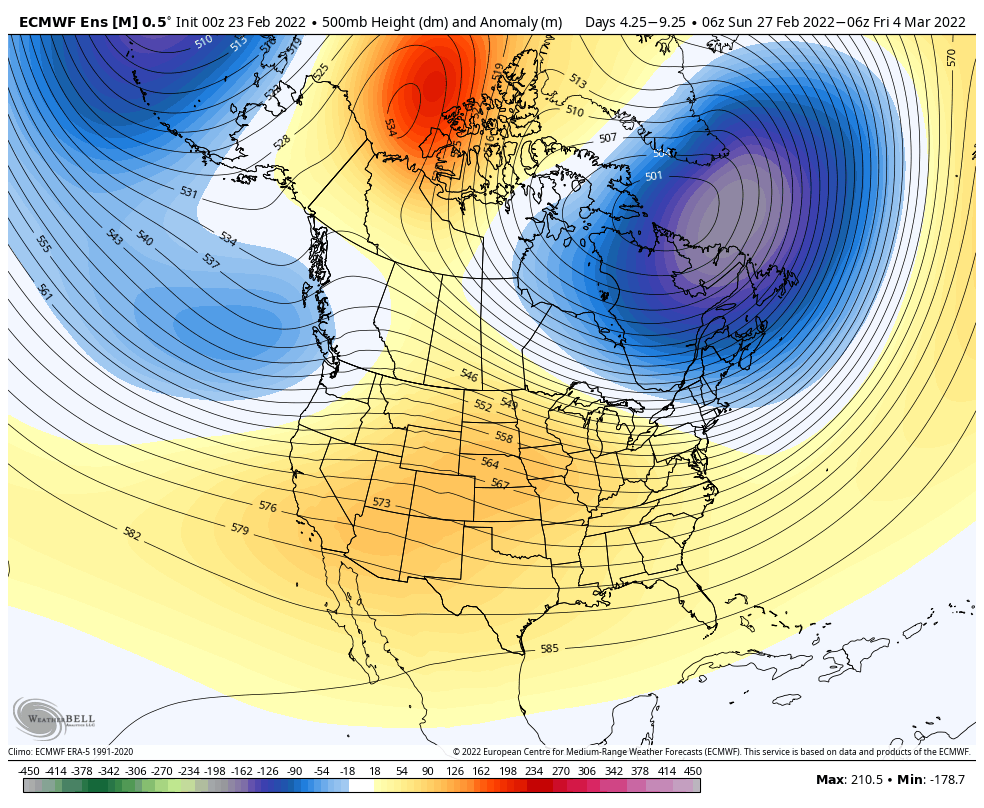
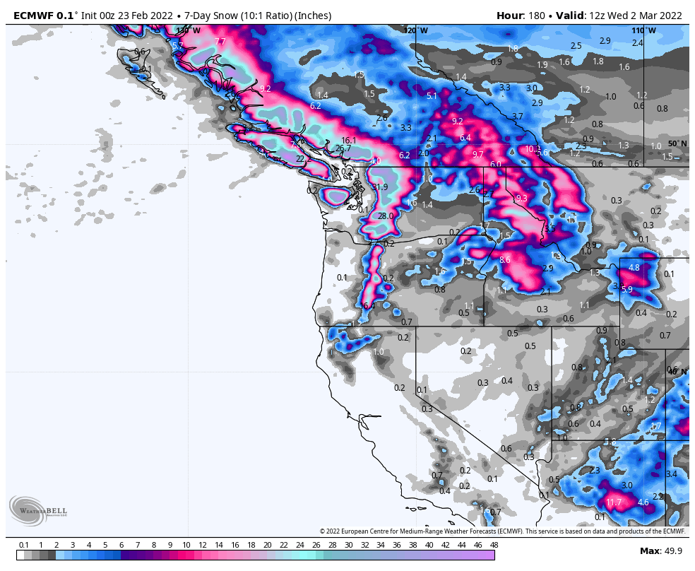
A couple of storm systems will finally bust through the offshore ridge this weekend, leading to about 5-6 days of wet weather beginning Saturday evening. The 5-day height anomaly plot for next week shows a weak trough offshore with westerly flow. Hooray!
The melting level will be near or below pass level for most of these events, leading to some decent snowfall totals in Washington and BC. Unfortunately, the snowfall forecasts look less impressive for Oregon and California.
Early indications are that the offshore ridge will attempt to re-establish itself in early March, centered closer to Alaska. This would generally mean colder and drier conditions relative to normal. So spring might be on hold for a while longer.

Here in Bellingham, we received about an inch of snow early Thursday morning, but the sky has cleared allowing temperatures to drop (currently 23F). It warmed to 36F yesterday and clouded over, so I was thinking it might not be quite as cold last night, but the clearing resulted in the drop. The earlier winds were very persistent (going for about 30 hours) and the advisory was fairly accurate, although initial timing was off. Our highest gust was 42 mph. We are about a mile from the Bellingham Airport, where the highest gust was 67 mph. This large differential between our place and the airport is typical as the airport is very exposed and we are somewhat protected.
Even though it has been cold, so far during this spell there have not been any record cold temperatures for the date in Bellingham.
I have a weather station and am part of the NWS Citizens Weather Observer Program (CWOP). Our weather reports appear on the NWS site and can be found here:
https://www.wrh.noaa.gov/mesowest/timeseries.php?sid=AV482&num=72&banner=gmap&raw=0&w=325
LikeLike
Strong trade winds look to be reenforcing/strengthening the La Niña:
It will be interesting to see how this affects local and global weather this spring.
LikeLike