

Social media has begun to hype the possibility of a significant windstorm in western Washington on Friday night. While uncertainty remains very high, there is enough of a possibility of a significant event to warrant taking a closer look…
Where is the storm right now?
It doesn’t exist yet! The energy source for the storm does exist–as of midday Tuesday the map below shows a very strong zonal jet stream in the North Pacific.
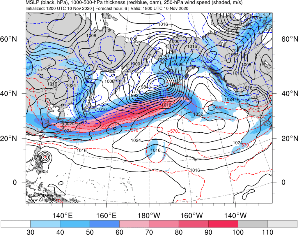
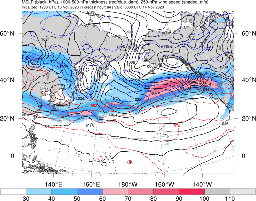
By Friday evening, the strong jet stream will approach the PNW. A surface area of low pressure is expected to form on the poleward side of the jet stream and rapidly deepen from on Friday as it approaches Vancouver Island.
Is this an ideal track for a windstorm?
As detailed by PNW windstorm expert Dr. Wolf Read, the surface low pressure center can approach the PNW from a variety of directions. The upcoming storm is expected to approach from the west (close to the 50 degree N parallel), which is a less typical but not unheard of approach.

Approaches from the south or southwest tend to have greater impacts on the Pacific Coast, but a westerly approach can still bring strong winds to Puget Sound, provided that (1) the low is deep enough and (2) the low track is generally over the southern end of Vancouver Island.
What are the models projecting?
Since we are still looking 3-4 days in advance, it is better to use an ensemble approach rather than examining any particular deterministic model run. Again, the two things we are looking for are the track and minimum pressure of the low center.
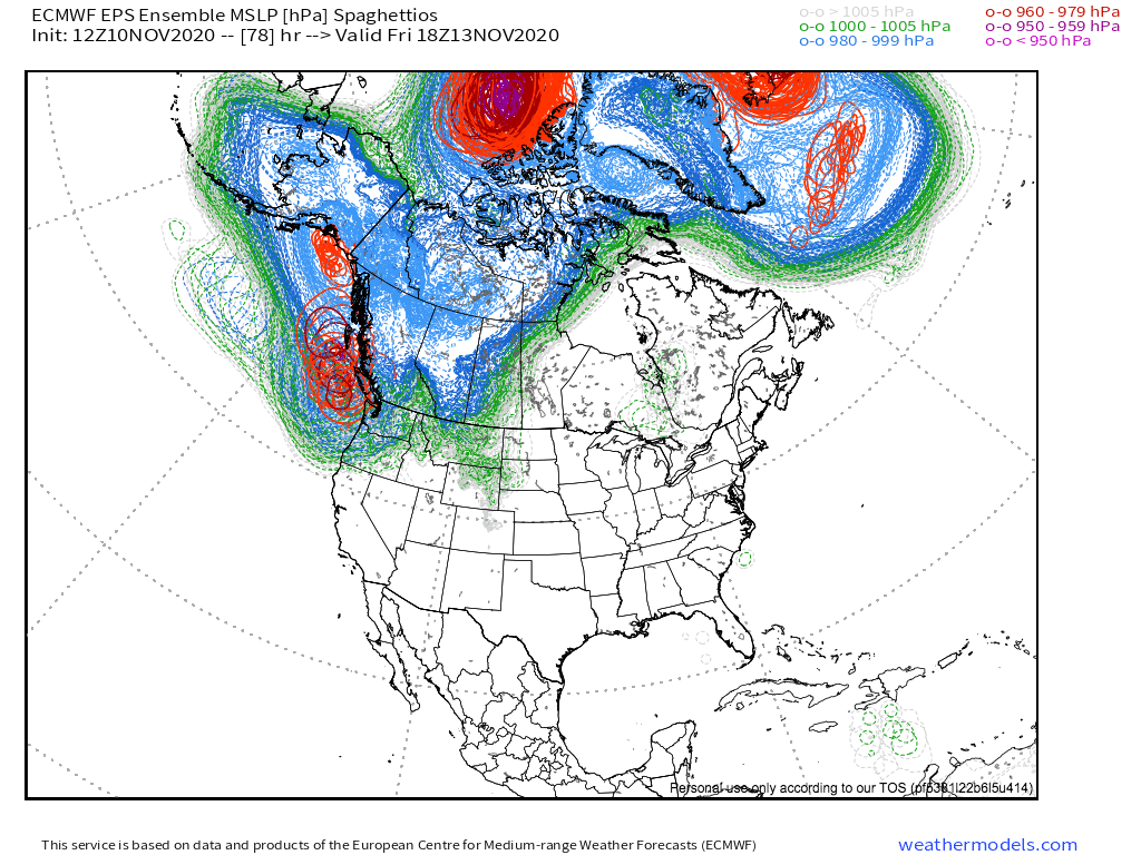
First, the ECMWF EPS ensemble. This “spaghettio” plot shows contours of the minimum sea-level pressure all 50 members of the EPS. Red circles indicate the position of very intense areas of low pressure below 979 hPa. Currently there is no consensus on the position of the low–but the average position is generally off the northern tip of Vancouver Island.
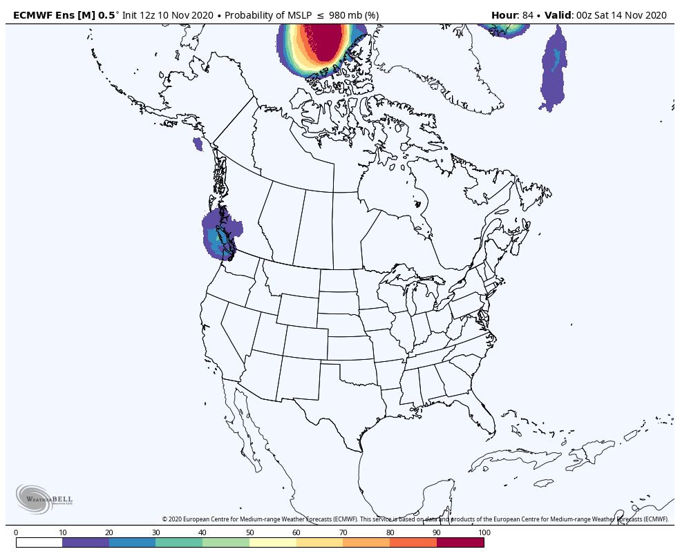
Another way to visualize the low positions is to look at the probability of sea level pressure below 980 hPa. The EPS shows highest probabilities over Vancouver Island, which would be a great track for a significant windstorm.
Next, the GEFS. Unfortunately I could not find a “spaghettio” plot for the GEFS, but looking at the probability of sea-level pressure below 980 hPa suggests a track farther north than ideal.
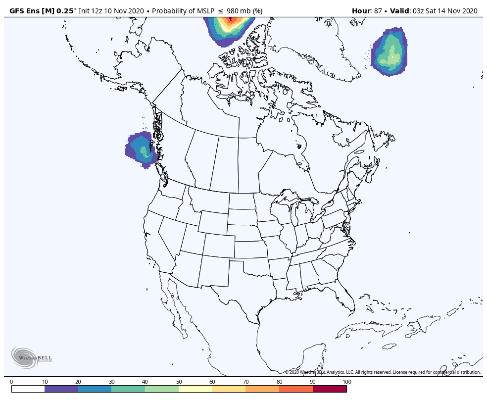
However, the probability of sub-990 hPa is in a more favorable position farther south, with the highest probability around the northern tip of Vancouver Island.
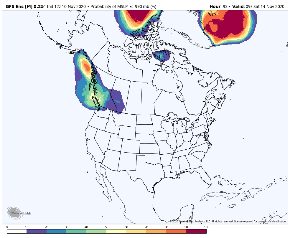
A low in the 980s hPa tracking in the right spot could still bring very strong winds to Puget Sound and the Washington/BC coast. Low pressure in the 970s hPa remains within the realm of possibilities, although the GEFS suggests that if a stronger low does develop, it would most likely end up too far north to bring a severe windstorm to Puget Sound.
The ‘cone of uncertainty’
There are many similarities between forecasting hurricane intensity/position and windstorm intensity/position. While the model tools that we have for hurricanes do not (yet) exist for windstorm tracking, we can still put together the ensemble projections into a forecast.

Generally there is good agreement on the development and westward movement of the low pressure center through Friday morning, but beyond that time we do not know (1) if rapid deepening will occur; and (2) if the low will take a more southerly track across Vancouver Island that favors stronger winds in Puget Sound.
The above forecast also fails to capture uncertainties in the timing of the low track, which are considerable.
Impacts
At this time, it is likely that a significant storm will impact the PNW on Friday night, so it is worth taking early precautions. Windy conditions, high surf, and coastal flooding are possible. Whether this will be a significant wind event or not is still unknown.
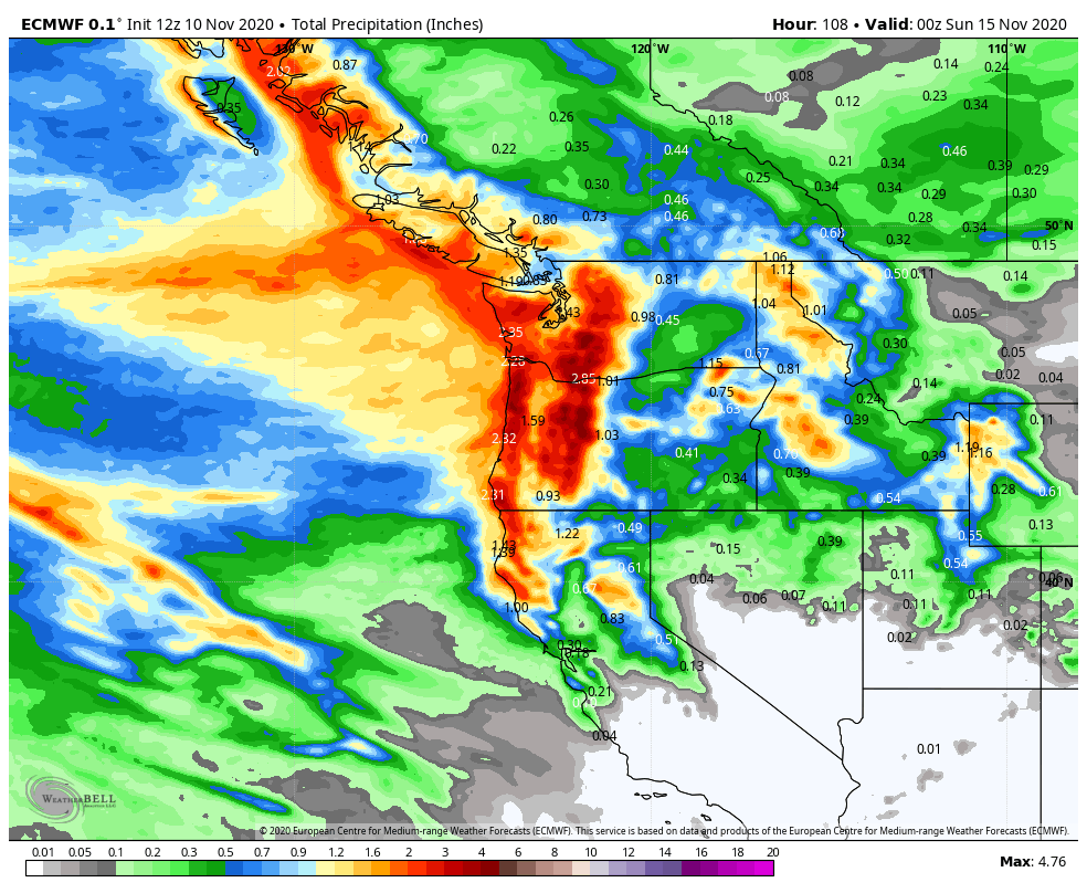
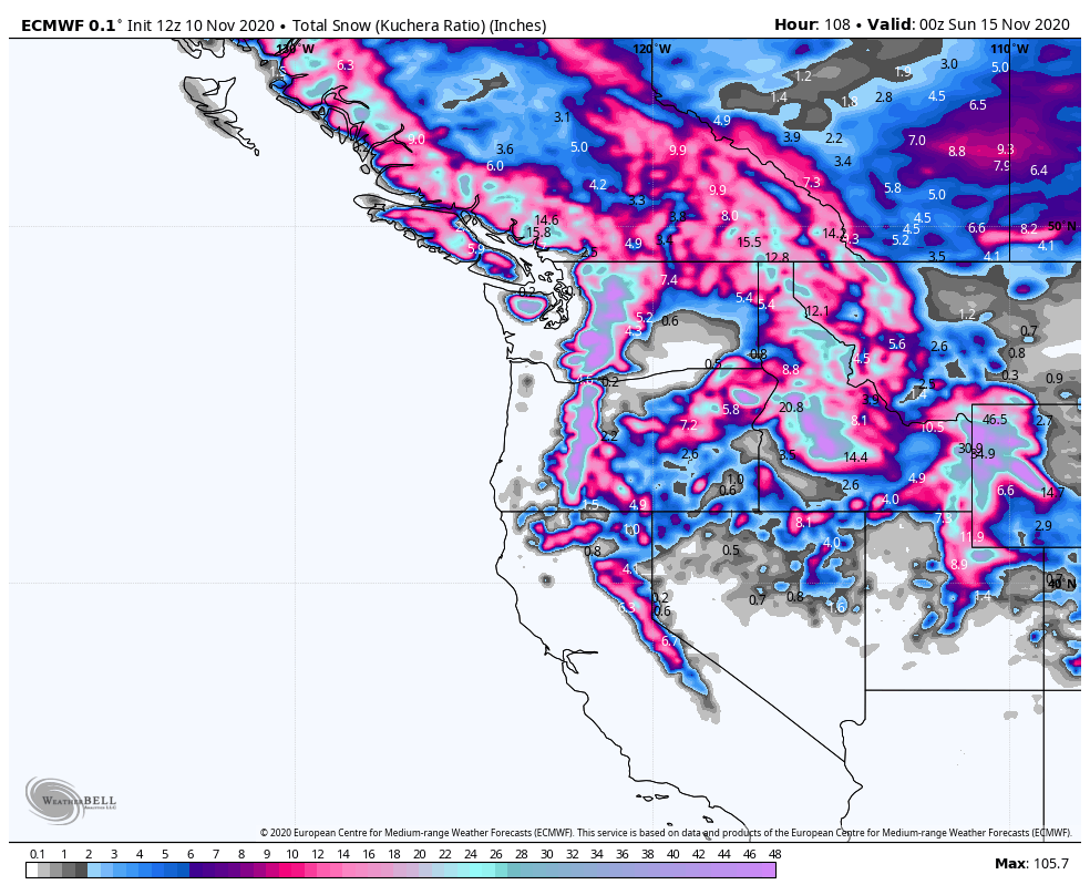
One thing we can be fairly certain of is that combined with an earlier storm on Thursday night, there will be significant rain and mountain snow accumulations by Saturday night. So get your storm drain unclogged and skis ready!

It’s interesting how models can show different possibilities but still point to the potential impact on western Washington.
LikeLike