

The PNW has gotten a few teases of fall weather in early September, but overnight Thursday into Friday morning (9/17) will bring a rapid transition into the rainy/blustery/chilly type of fall weather that many of us have been craving for several months.
The early fall transition to rainy season is brought on by the northern hemisphere tilting away from the sun, which increases the temperature gradient between the equator and the north pole. The atmosphere responds to this transition with a strengthened jet stream and, consequently, stronger mid-latitude frontal cyclones.
The jet stream is best visualized on the 250 hPa map forecast for Thursday below, with the pink ‘jet streak’ over the central Pacific pointing its finger directly at the PNW.
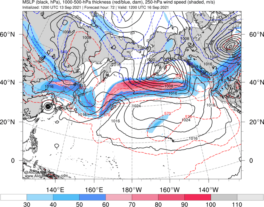
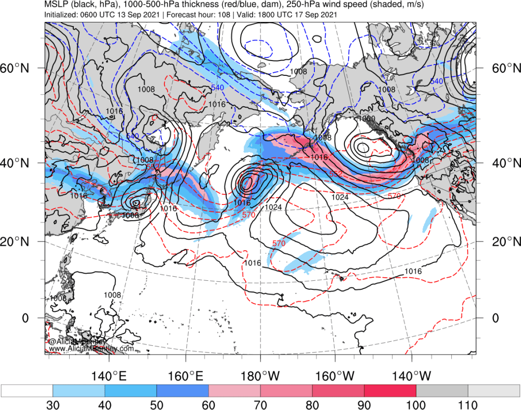
Just 30 hours later (Friday midday), a frontal cyclone (black contours) is expected to spin up to the west of British Columbia and track southeastward toward Vancouver Island by Saturday.
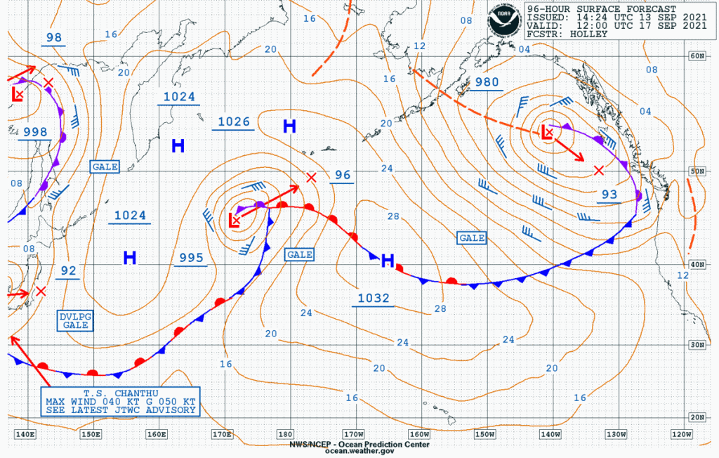
The forecast surface chart from NOAA’s Ocean Prediction Center predicts a 980 hPa low with a trailing occluded front approaching the coastal PNW by 4 AM Friday morning.
Fall storms are especially potent because of the extra energy/moisture available from the Pacific Ocean after a summer’s worth of heating. So naturally this cyclone will tap into some of that oceanic moisture reserve via a strong atmospheric river.
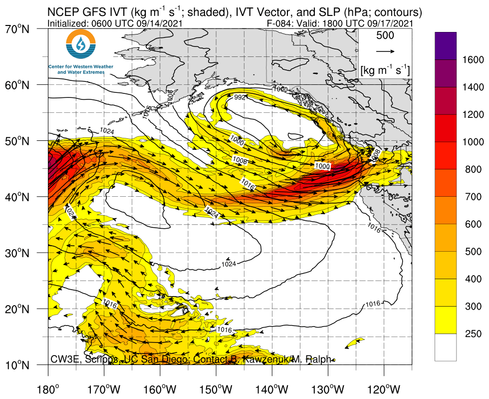
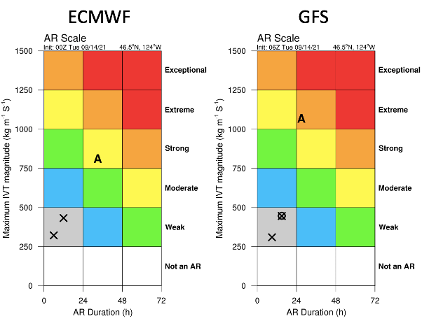
California’s Center for Western Weather and Water Extremes (CW3E) puts out fantastic forecast products to diagnose the incoming storm. Both the intensity and duration of the atmospheric river (AR) matter for impacts. The ECMWF and GFS are not yet in agreement on either, with the ECMWF forecasting a slightly longer but weaker AR while the GFS has a shorter but stronger event. The ‘A’ symbol in the image below shows where the upcoming storm is predicted to fall on their matrix.
Although some uncertainty remains, we can certainly expect significant rainfall with some potential for hazards in the form of localized flooding. The majority of the heavier rain associated with the AR will fall on Friday afternoon and evening.
How much rain is expected to fall?
Even though the heaviest rain will fall on Friday, the event as a whole will last through the weekend. The Seattle NWS office is predicting storm totals of 1-3 inches of rain for most of western Washington.
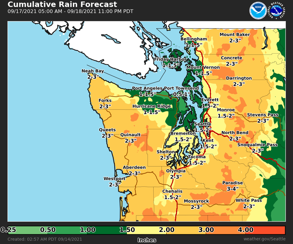
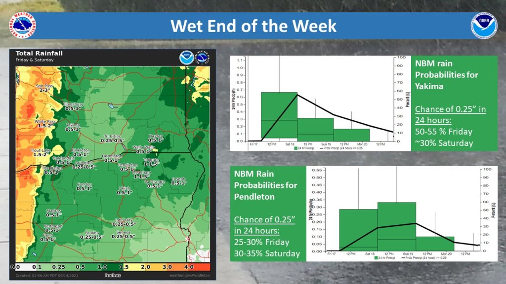
Another plus to the atmospheric river being positioned close to the WA/OR border is that significant moisture will penetrate east of the Cascades. NWS Pendleton is predicting at least a quarter-inch of rain for all of central and eastern Washington with up to an inch or more in far-eastern WA and the Blue Mountains.
However, this rainfall will NOT erase the drought, not by a long shot. Spokane and Wenatchee are both short about 5 inches of rain this year, so it will take several more of these storms to come even close to getting back to normal rainfall for 2021.
Is there any uncertainty? Not much at this point. The ECMWF ensemble mean is around 2 inches of rain for Seattle over the weekend.
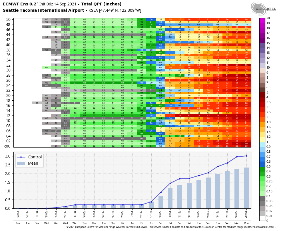
The GFS ensemble is a bit lighter, closer to 1.5 inches for Sea-Tac. The key difference with the GFS, as we saw in the AR analysis above, is that a shorter duration but heaver rainfall is expected on Friday.
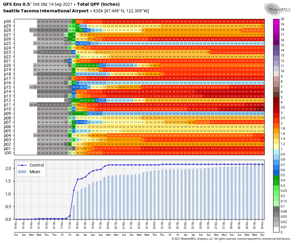
Either way, it’s going to be really wet on Friday afternoon.
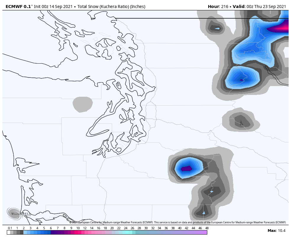
Snowfall above 6,000 ft
One of the saddest images of the summer has been the exposed, dirty glaciers on Mt. Rainier. When the mountain comes back out next week, it will look closer to ‘normal’ after snow levels drop to around 6,000 ft over the weekend. A few inches of snow are also possible in the North Cascades.
Wind
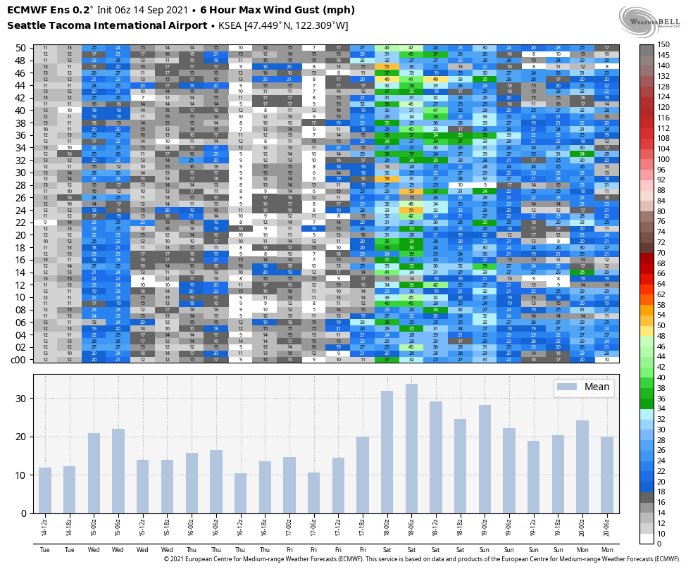
Early-fall storms are notorious for causing power outages with relatively weak winds, as the leaves are still on deciduous trees and the weakest limbs haven’t been exposed to a storm since last spring.
The strongest winds in Puget Sound are expected late Friday into Saturday. Most places will likely see maximum gusts in the 25-30 mph range, but the ECMWF ensemble for Sea-Tac does show a couple members with stronger winds. So we’ll have to keep an eye on the winds.
Thunderstorms
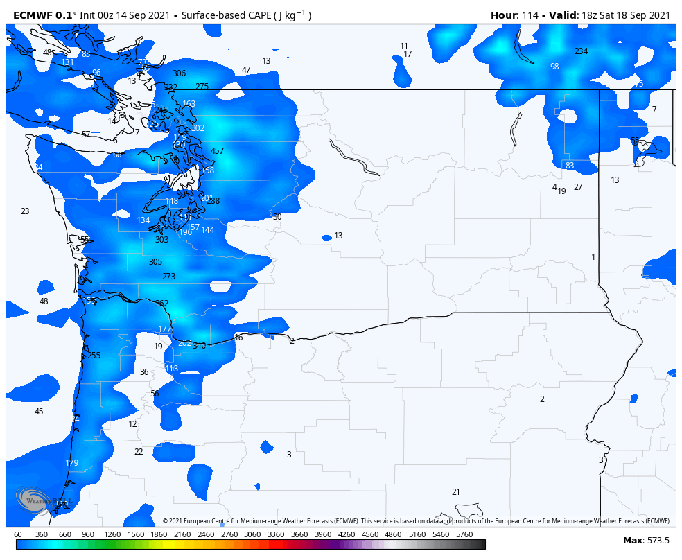
Conditions will be favorable for thunderstorms in western Washington on both Saturday and Sunday afternoon. After the initial cold front passes on Friday night, an cold air aloft associated with an upper-level trough will destabilize the atmosphere, especially in the afternoon hours.
The ECMWF shows decent (for this part of the world) values of convective available potential energy (200-500 J/kg) on midday Saturday, so expect to see isolated storms, especially closer to the foothills of the Cascades.
The big picture
A beneficial storm system will bring rain to all of the PNW starting Thursday night with the heaviest rain falling on Friday as an atmospheric river passes through. It could be windy for a period on Friday night as the cold front moves through. Showers and isolated thunderstorms will continue through the weekend, before conditions dry out early next week.
In short, time to put away the watering cans and hoses and get out the rain gear and hot drinks.

Looking forward to this storm bringing an end to this long, hot, dry summer. Do you think this will put an end to fire season in the PWN (west side, at least) for now? Thanks for the report, I appreciate the mix of text and visuals.
LikeLike
Yes for west side…would like a couple more storms for east side since it looks like it might dry out again for the rest of the month.
LikeLike
As the NWS discussion indicates, I think the issue with the winds (which would not be that unusual during the stormy season), will be trees still having a lot of leaves as well as some being weakened by the earlier hot and dry weather. Here in Bellingham, we have a quite a few cedars on our property. The annual needle browning and drop looks above average to me. The cedars do not seem to handle the hot and dry weather stress as well as the Doug fir and pines.
LikeLike