

Meteorological spring (March-April-May) has come to an end, and it will go down as one of the coldest springs on record in Washington State. It also snaps a 10 year streak of springs falling in to the near-normal or above-normal category.
A top-5 coldest spring in many locations
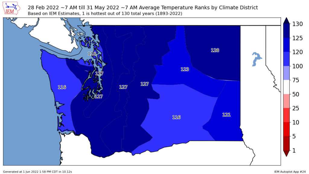
Overall, spring 2022 was the 4th coldest across much of Puget Sound in 130 years of records. It ranked in the top 15 coldest across the entire state.
Sometimes monthly or season extremes can be driven by one or two extreme events, such as the June 2021 heat wave. In this case, the seasonal extreme was driven more by consistently cool weather throughout almost all of April and May.
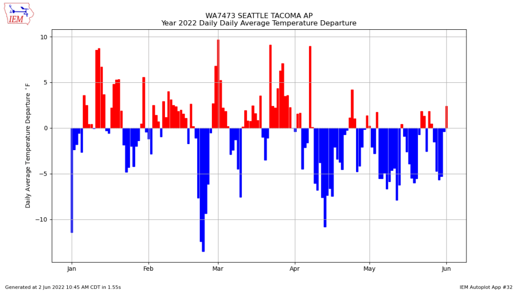
The daily average temperature departure from normal at Sea-Tac shows that after near-normal temperatures in March, around 75% of days in April and May were below normal. Only one day in the entire spring, April 7, was well above normal.
How does spring 2022 compare to past years? The plot below shows the number of days in spring with a high temperature at or above 70°F by year. The 70° threshold was reached at least ten times for ten straight years prior to 2022 and only three times in 2022.
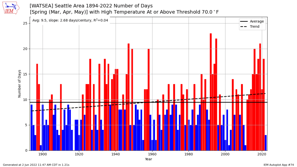
There is considerable year-to-year variability in the number of warm days in spring, but generally the trend has been toward more days reaching 70°F in recent years.
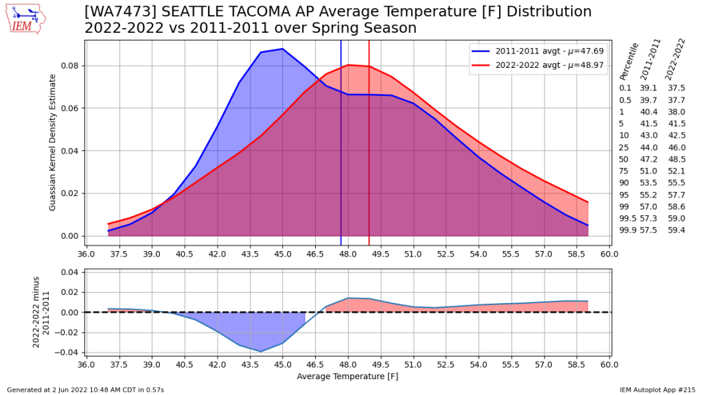
Prior to 2022, the last truly cold spring in the PNW was 2011. It turns out that 2022 was not as cold as 2011 in most locations, including Sea-Tac airport. The main difference was that 2011 was cold for all three months of spring, while only April and May were considerably below normal in 2022.
Before moving on, I would like to give credit to the Iowa State Mesonet automated data plotter, which helped me quickly make many of the plots used above. I often use Sea-Tac airport for my plot. Interested readers can make the same plots for other locations.
A warm and dry spring in California
While the PNW has been cold and wet, California and Nevada have been warm and near-record dry.
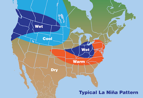
The above map is typical for La Niña years, but the ‘back to back’ La Niña years in 2020-21 and 2021-22, combined with climate change, has made the drought situation especially dire in the Southwest US.
Snowpack
One of the main results of the cold April and May have been a delay in the snow melt season. Paradise on Mt. Rainier is perhaps the most obvious example.
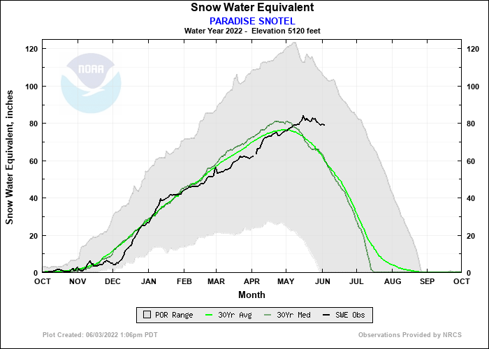
Snowpack was below-normal on April 1 and May 1, but the cool conditions and continued snowfall in May have resulted in almost no loss of snowpack as of early June.
Even some of the lower elevation sites, like Stampede Pass, are on pace for a melt out date about two weeks later than normal.
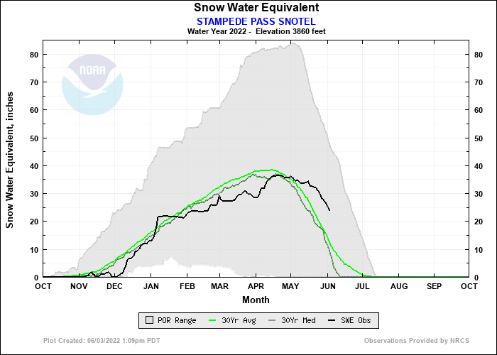
Quite the contrast from April 1, which is often considered the benchmark date for winter snowpack.
Outlook for summer 2022 and beyond
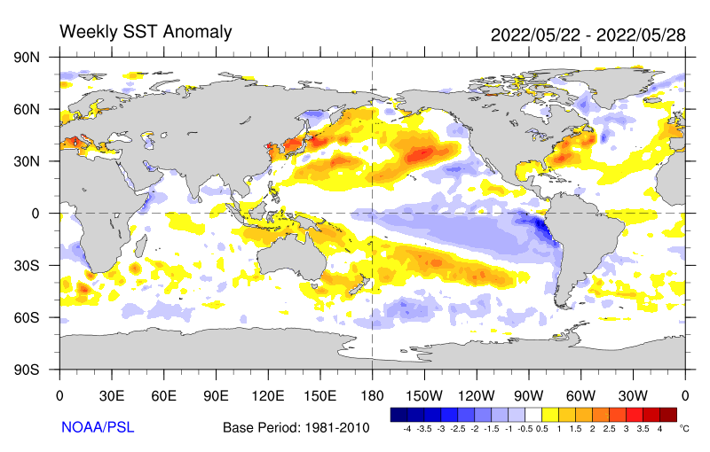
The latest SST anomaly plot shows that La Niña conditions remain in place. Additionally, cooler-than-normal SSTs are present off of the immediate coast of the PNW.
It’s hard to break out of this type of setup, both because of how this pattern tends to force a trough over the PNW on the large scale and how the locally cool SSTs provide further cooling, especially to the west of the Cascades. The good news for summer fans is that the influence of La Niña tends to wane as summer progresses, so there will eventually be some warmer weather this summer, most likely in August and September.
Looking farther ahead, the outlook for next winter suggests the possibility of a third consecutive La Niña winter. The odds of a flip to El Niño are around 5%.
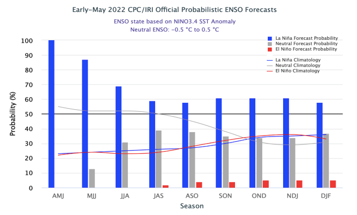
It’s not as uncommon as you might think to have the ENSO index in the negative territory for 3 or even 4 consecutive winters. The winters of 2010-11, 2011-12, 2012-13, and 2013-14 all were characterized by negative ENSO indices, although only the first two were officially classified as La Niña winters and the second two were ‘neutral’ but on the La Niña side of zero.
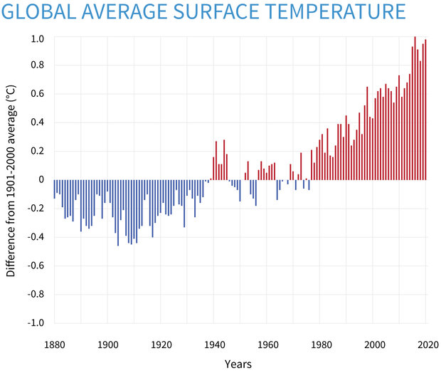
A brief reprieve from the effects of climate change
One of the nice things about natural variability is that we will continue to see variations between warmer and cooler periods, even as the planet warms. The first half of the 2020s seems to have landed on the cooler side for the PNW, but global temperatures are still quite warm, especially for a La Niña period.
It will be a rude awakening for many in the PNW when the Pacific flips back to El Niño and the effects of climate change are no longer assuaged by La Niña. The opposite may be the case in California and the rest of the US Southwest, as El Niño years tend to result in more precipitation.
