

In the central US, the weather occasionally flips from 75 degrees to snow in a matter of hours. In the PNW, we’ll have to settle for about three weeks. Given the summer-like heat and smoke in mid-October, the flip to an arctic intrusion in early November will be about as dramatic of a change in seasons as we can see in this part of the world.
The setup
Following a strong atmospheric river on Friday-Saturday, all of the weather models are showing a typical PNW cold wave pattern developing. By Sunday, a ridge of high pressure will build over Alaska while a deep trough will dig southward along the west coast of North America.

The trough will be associated with an arctic airmass that will begin spilling into the PNW by late Sunday.
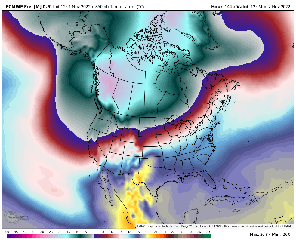
By Monday morning it will feel like winter across much of the PNW. There’s nothing especially unusual about this setup except for the time of year –the second week of November. It is typical to get several arctic intrusions of similar magnitude most winters in the December-February timeframe. .
Mountain snow and possibly some patchy lowland snow?
The main beneficiary of this pattern will be the mountain snowpack across the coastal mountains of the western US. The 5-day ECMWF snowfall forecast from Sunday-Friday morning shows the impressive amounts.

The ECMWF ensemble snowfall accumulation snows several feet of snow falling at Stampede Pass by the middle of the month. Some ski resorts may be opening early this year.

What about the lowlands?
Associated with the upper-air trough, a surface area of low pressure will meander to the south of Vancouver Island from Sunday through Tuesday.

The surface low will act to draw cold air through the mountain passes and will spin moisture and a few weak disturbances in from the Pacific Ocean. The GFS model (pictured) has generally been digging the low farther south than the ECMWF, which has resulted in the GFS forecasts looking a bit colder and snowier than what will likely materialize.
Relative to mid-winter, ocean temperatures are quite warm on average this time of year. On top of that, sea surface temperatures (SSTs) are running several degrees C above average immediately offshore of the PNW.
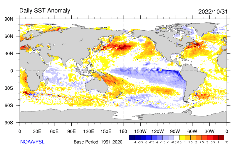
Cold air blowing over warm ocean waters is a recipe for convective showers. A similar but weaker setup was occurring on Tuesday (11/1). Visible satellite imagery shows the open-celled convective showers over the ocean waters.

These type of convective showers are known to be impressive mountain snow producers, but they are often weaker and isolated in the lowlands unless they are associated with a convergence zone or a weather system that organizes them into bands and provides some extra lift.
It doesn’t look like there will be any snowstorms within this cold period, so the prospects for lowland snow depend on some of these convective showers being organized enough to bring snowflakes to at least some of the lowlands.
I expect that we will see scattered reports of lowland snow across western WA and OR as some of the heavier of these convective showers briefly bring the snow level down to the surface. In that scenario, it is possible to quickly pick up a bit of snow accumulation which usually melts within an hour.
Any serious travel disruptions will likely be confined to the mountains.
Is this a preview of more cold and snow this winter?
Possibly. We are entering a third straight winter with La Niña conditions and the previous two winters have both delivered several decent cold snaps. However, La Niña is expected to weaken by late winter so perhaps best chances for cold and snow will come earlier this winter. Only time will tell.
