

After most of October featured summer-like weather across the PNW, an entire autumn season’s worth of weather has been packed into the past three weeks. The period since Friday has been especially newsworthy as an atmospheric river followed by a westerly wind surge caused widespread power outages on Friday night. Saturday night featured heavy snowfall in the Cascades and north-central Washington with Snoqualmie Pass setting a milestone for the most snow through the first week of November in at least 20 years.
On Monday, the storm in the last four days moved into western Washington, a low pressure system embedded in a usually cold airmass was responsible for several waves of convective activity that brought rain, hail, snow, and thunder western Washington.
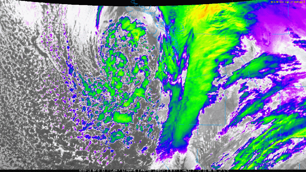
The low was beautiful to watch on satellite imagery. The surface low was easy to follow on an IR satellite loop.
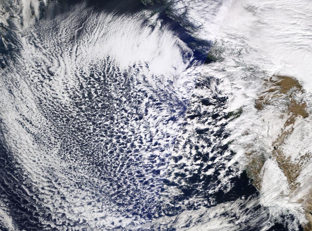
The view from MODIS was even more aesthetically pleasing.
The cellular convective activity over the northeast Pacific was a result of cold air of arctic origins flowing over ocean waters that remain above normal after an unusually warm early autumn.
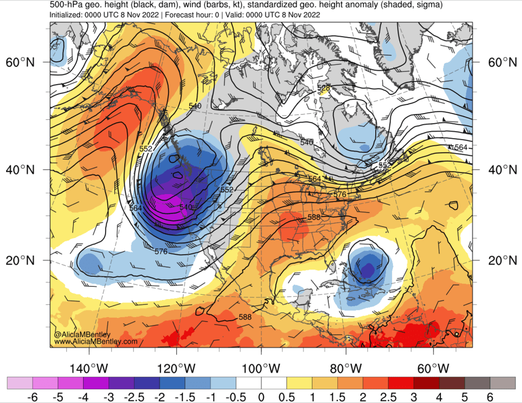
The blues and purples on the 500 hPa anomaly map were just as pleasing to the eyes, especially after several months of persistent yellows and oranges associated with ridging.
First arctic air outbreak of the year
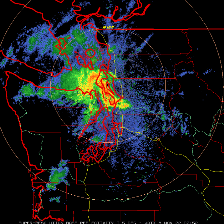
As area of convective showers moved northward though Puget Sound on Monday evening, they encountered arctic air that was flowing southwestward through the Fraser River valley.
Snow fell near sea level in Bellingham as well as in portions of the northeast side of the Olympic Peninsula. Around 7 PM Monday night, radar showed a heavy shower over Whidbey Island and widespread precipitation hugging the edge of the Olympic Mountains.
Upslope snow events on the Olympic Peninsula associated with Fraser River outflow are one of the more quirky of western Washington’s local weather phenomena. When the trifecta of cold air, strong winds, and available moisture are perfectly aligned, snowfall can accumulate rapidly down to Sequim and Port Angeles. Weather models rarely show much skill in predicting snowfall amounts in these events.
Snowfall was observed along US-101 on Monday evening, with up to 5 inches accumulating in the foothills south of Sequim.
Cold and sunny this week
The extent of the arctic air outbreak could easily be seen on an 850 hPa temperature anomaly map on Monday evening.
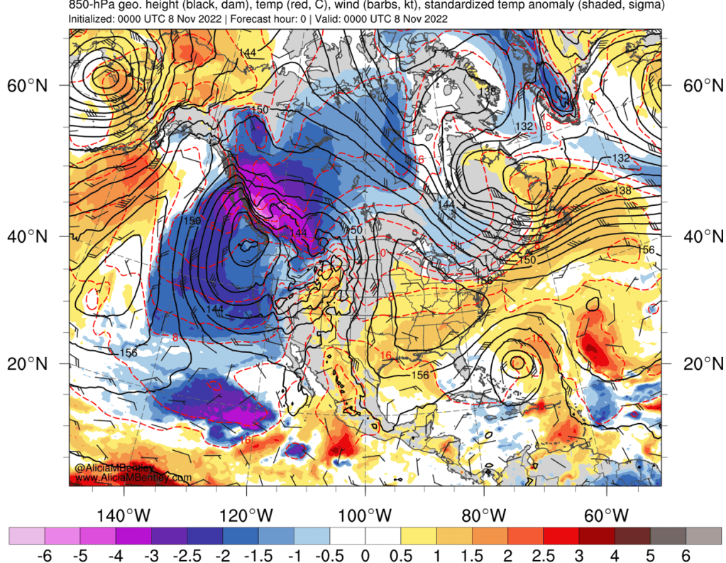
While the coldest anomalies are over land, a significant stream of cold air has also spread across a broad swath of the northeast Pacific ocean.
Even as the trough weakens and moves away, it will take a while for the large extent of cold air to be eroded. High pressure will clear out cloud cover and overnight temperatures will plunge below freezing on Tuesday night almost everywhere except the immediate coast.
Quiet weather may continue into next week
The ensemble mean height forecast for the third week of November showed a familiar sight from summer — a blocking ridge along the west coast of North America.
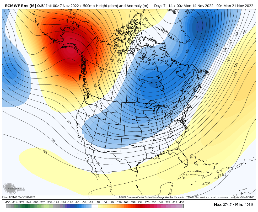
Given the time of year, it is likely that a ‘split flow’ pattern will develop with a few storms making it around the ridge to the south and reaching the west coast of the United States by sometime next week. It is too soon to tell when a transition back to a wetter pattern might occur.
