

Climatologically speaking, the second half of November is the peak of rainy season in the PNW. Practically speaking, the ebb and flow of the jet stream can occasionally bring weeklong respites from the rain at any time throughout the fall and winter.
The dry spells rarely last more than a week and never as long as a fortnight. At Sea-Tac airport, the current dry spell has reached 11 straight days as of Friday, and has a chance to tie the November record of 13 dry days in a row set in the year 2000 (via @KSeattleWeather).
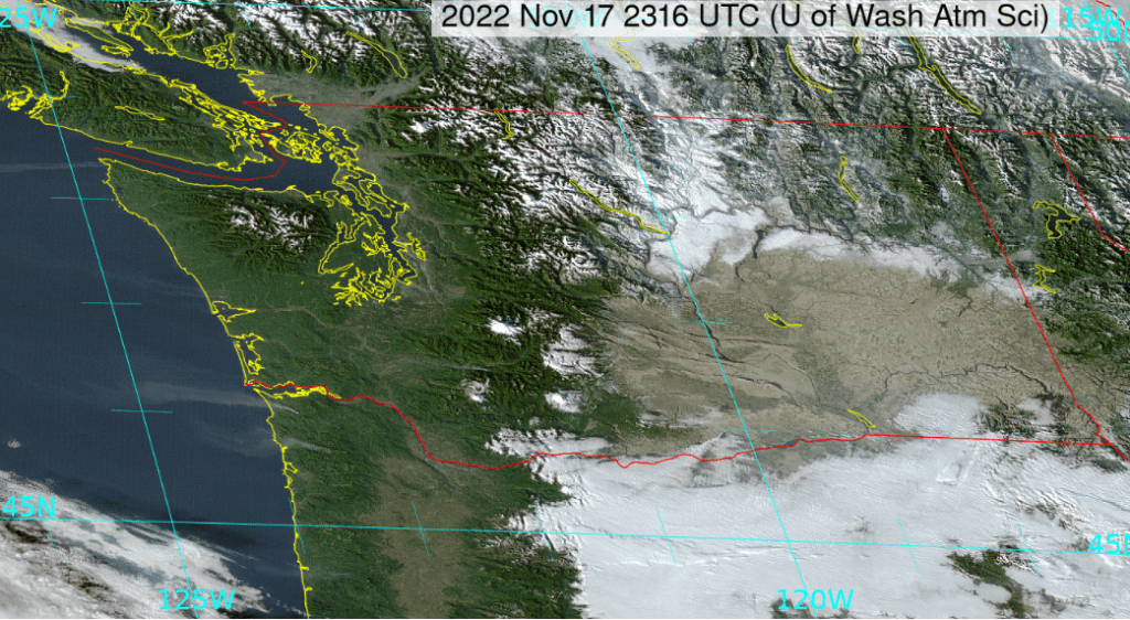
This time of year it is common for dry spells to lead to widespread inversions and fog in the lowlands, but that hasn’t happened this time. Visible satellite imagery showed crystal clear skies across almost all of Washington State on Thursday afternoon.
The lack of cloud cover was largely the result of cold, dry easterly flow as the PNW caught the edge of a widespread cold air outbreak that has spread across most of the continental United States.
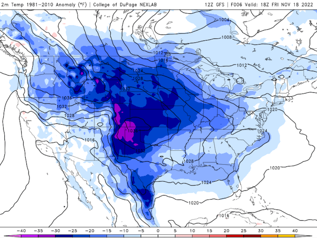
Surface temperature anomalies were below normal on Friday almost everywhere in the lower 48. The upper-air map associated with this pattern was something to behold.
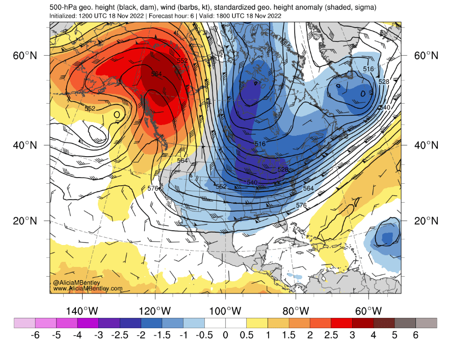
The yin and yang of warm and cold anomalies looks like a piece of meteorological art. Notice the strong northerly winds blowing directly from the polar regions through central North America before turning easterly over the Upper Midwest.
Another unusual feature that can be seen on the above visible satellite image are 4-5 smoke plumes originating near the WA/OR coast and extending out over the Pacific Ocean. The northernmost plume was apparently the result of a burn pile that spread out of control and burned an entire hillside on the Makah reservation, prompting evacuations. At least 4 other fires were burning on Friday according to the Washington State DNR.
It was unclear whether the dry summer-early autumn weather contributed to these fires or if was just the unusual timing of an easterly wind outbreak at the end of an extended dry period within rainy season. For what it’s worth, the winds were well-forecast by the National Weather Service, so any controlled burns should have been postponed.
One weak storm early next week, then dry weather returns for Thanksgiving
The highly-amplified pattern from this week will briefly transition back into zonal (west to east) flow for the start of Thanksgiving week. A frontal system is expected to reach the PNW on Monday, bringing an end to the current dry spell.
Models have come into better agreement for the second half of next week. Instead of storms a transient ridge is expected to build along the west coast of the US by Thanksgiving.

An atmospheric river that had threatened to impact Washington and Oregon will instead make landfall to the north, over British Columbia.
So after just a single storm, it looks like the weather on Thursday and Friday will be quite pleasant for the most part.
Models are predicting more precipitation by next Saturday or Sunday. As of right now there is no sign of any large storms on the horizon.
