

As advertised, another cold snap is about to take hold in the PNW. Cold air will filter into the region Sunday night into Monday and stick around for about a week.
Scattered snow showers will be possible on Monday and Tuesday, but the most interesting period will be from Tuesday night into Wednesday when a strong frontal system will approach the PNW from the northwest.
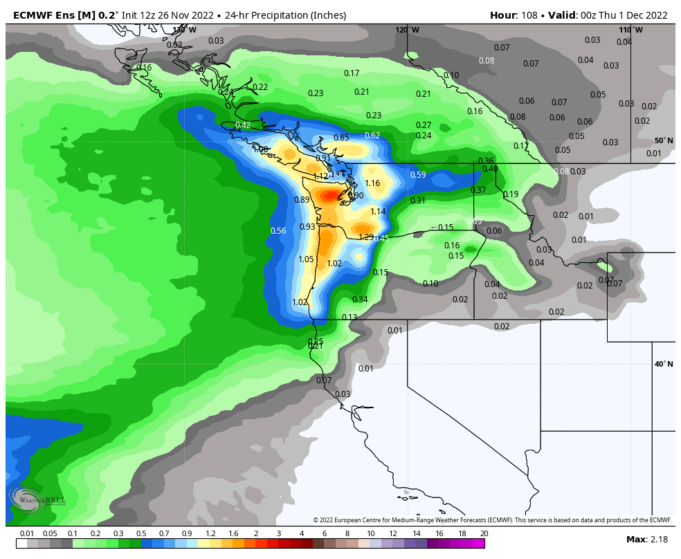
Plenty of moisture available
Usually lowland snow events are limited by the difficulty of having both sufficient moisture and cold air available at the same time. This particular storm will have no shortage of moisture and will be limited by rapidly eroding cold air. Both the ECMWF ensemble (pictured) and GFS ensemble means show around one inch of liquid equivalent falling in the lowlands from Tuesday evening through Wednesday.
Cold air in place initially
The leading edge of the warm front will approach western Washington on Tuesday afternoon. At the onset of precipitation, it should be cold enough for at least a few flakes to fall, especially Seattle and north. The ECMWF has the temperature just above freezing in Puget Sound at 4 PM Wednesday.
Note the plentiful supply of cold air in eastern Washington, as well as the slightly colder temperatures in Whatcom and Skagit Counties. Locations in proximity to the colder air — near the passes and the Canadian border — are the most likely to see appreciable accumulations from this storm.
Upper-air temperatures will initially be cold enough for snow as well, but just barely. If the model forecasts end up being even slightly too cold, this will start as rain in most places
Rapid warming on Tuesday night
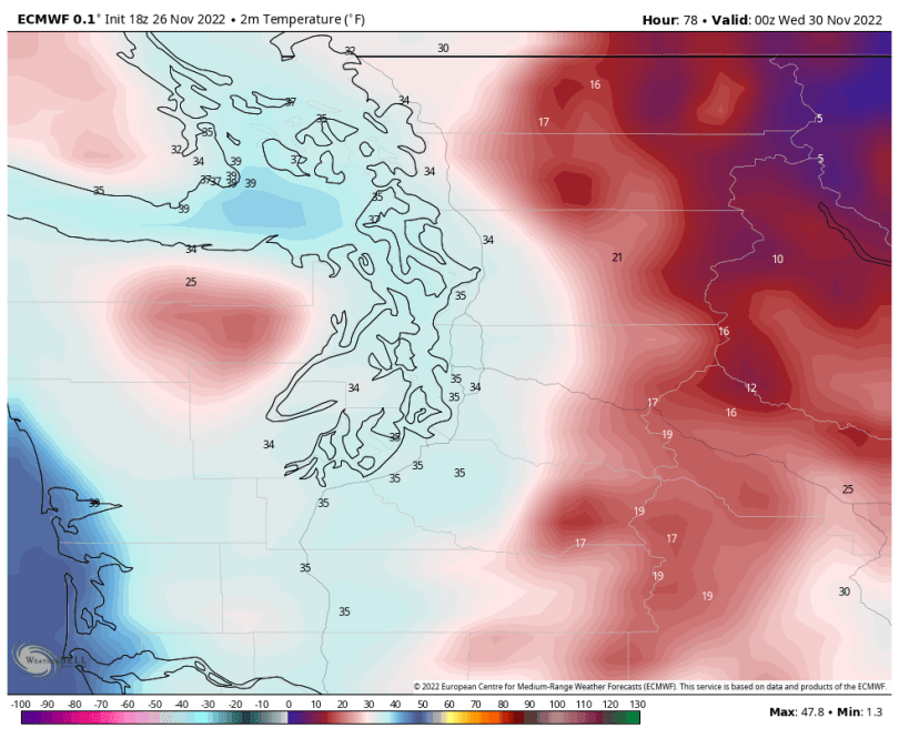
Temperatures will warm rapidly aloft Tuesday night as a warm front approaches. The current ECMWF run has the 850 hPa temperature (~5000 ft elevation) rising all the way up to 0°C by 06 UTC Wednesday (2 AM) over the Seattle area.
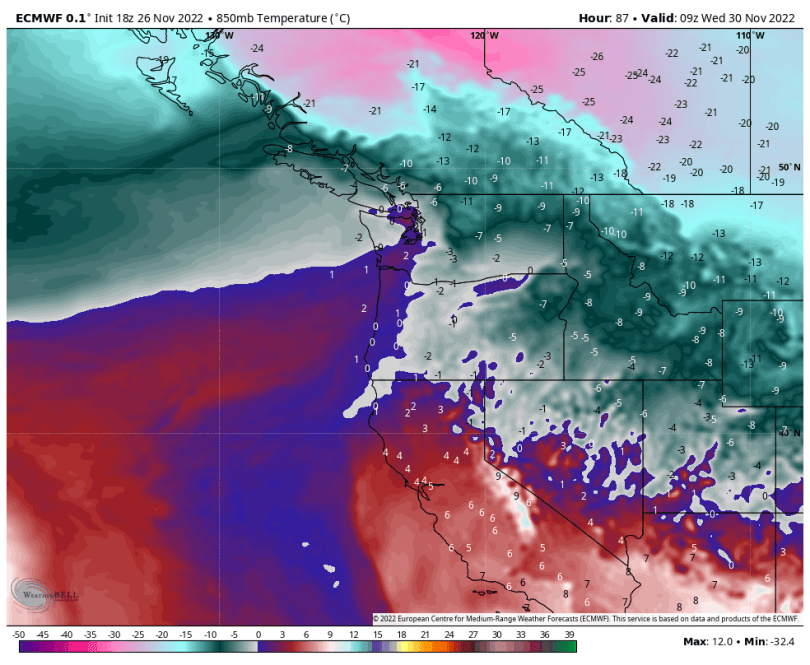
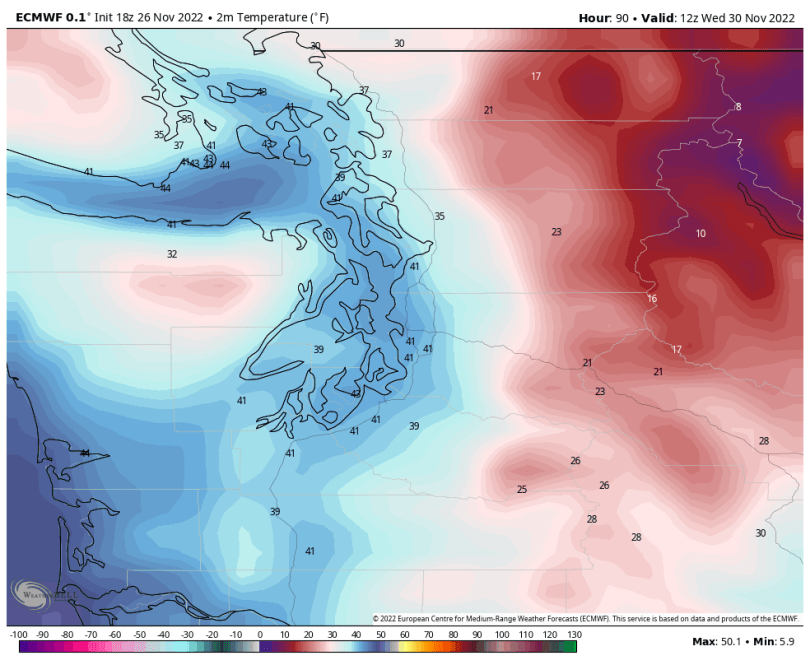
Colder air will remain entrenched north of the border as well as closer to the Cascades. But for most of the lowlands, this is bad news for snow. It will not be an especially close call either, Seattle will likely wake up to temperatures close to 40 °F on Wednesday morning with steady rain falling.
If Seattle gets lucky, an inch or two of snow could quickly accumulate on Tuesday evening, but it will be quickly wiped out by the rain.
Areas north of Seattle have a better chance of staying all snow longer, especially areas close to the mountain passes where easterly winds will supply colder air on Tuesday night. I could see Everett and north getting closer to 2-4 inch accumulations before switching over to rain. Areas that tend to stay cold the longest in this type of event — Bellingham and North Bend in particular — could see 3-6 inches or more.
More snow possible on Thursday
Temperatures will quickly turn colder again on Wednesday night as another wave of arctic air moves in. An upper-level trough associated with the colder air is expected to swing through on Thursday, which should provide enough moisture and lift to generate snow showers. Nothing impactful is expected at this time, but it bears watching, especially if a convergence zone forms.
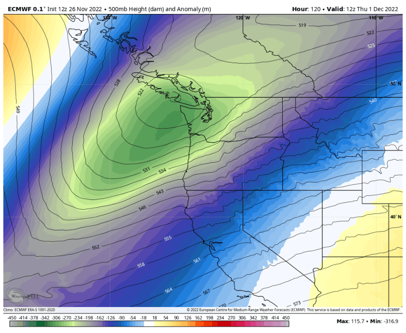
Those are some impressive cold anomalies!
There are at least some hints of yet another storm system next weekend while the cold air is still around, but the models are split between another storm and a cold, sunny weekend.
Plentiful mountain snow
The mountains will get absolutely hammered from this storm cycle — both on Saturday night into Sunday as well as Tuesday into Wednesday. Several feet is expected to fall at the passes. Travel impacts will be significant.
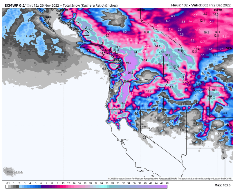
The best time to travel through the passes will be late Monday through early Tuesday.
November 2022 has already been running quite cold, so this upcoming cold wave will lock in one of the coldest Novembers in recent memory for much of the PNW.

The NWS wind, low temperature, and snow forecasts for Whatcom County were somewhat off the mark in the latest round of weather. The Frazier River outflow really did not amount to much in Bellingham and it did not last very long.
It looks like precipitation in Bellingham for the month of November will be on the low side as there were 20 days with little or no precipitation and only 5 days with at least moderate precipitation. If it wasn’t for almost 2 inches of rain on November 4, this would have been an unusually dry month.
LikeLike