

The Pacific Northwest has seen little in the way of true winter weather so far this year. With the days getting longer and spring rapidly approaching, time is running out to get some real cold into our region.
One month ago I wrote about the possibility that the polar vortex would be paying a visit to the United States this winter. That forecast has become a reality, particularly in the central US where the initial wave of arctic air has already moved in.
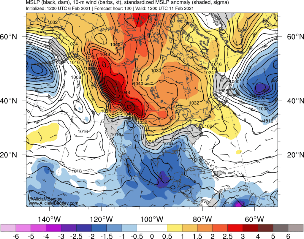
The atmospheric conditions leading to this event can be visualized at the 500 hPa level on a northern hemisphere projection, shown below.
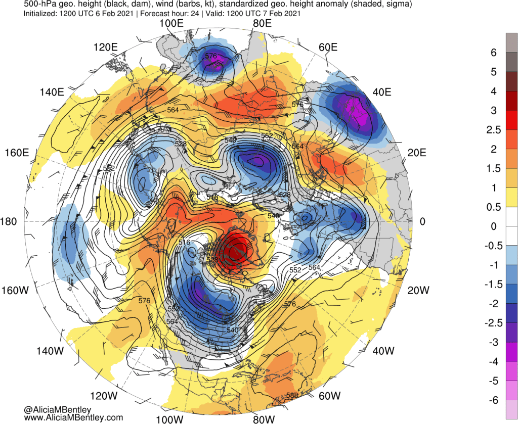
While your eyes might be initially drawn to the blue/purples representing anomalously cold air, two key features on this map are actually orange and red in color.
The first key feature is the big red blob over Greenland, a blocking area of high pressure which has induced easterly (backwards) flow over northern Canada. A second helpful feature is the ridge of high pressure over the northern Pacific into Alaska. Since air masses flow around these features, a pathway is open to funnel arctic air directly from Siberia across the North Pole and into southern Canada and the US.
The trajectory analysis in Eric Webb’s tweet shows the “Siberian Express” aimed at the northern Plains:
Initially, the arctic air intrusion will be largely east of the Rockies, with a glancing blow to the PNW. The trajectory analysis nicely illustrates how some of the colder air will ‘leak’ into the Pacific via Alaska and arrive in the PNW as a modified airmass from the west. That will be enough to get temperatures dropping below normal by early next week, but it will take a few more days for things to get really interesting.
When will the extremely cold air arrive?
This is the complicated/fun part of the forecast, and unfortunately there is still some uncertainty as to how things will evolve. Let’s look at the big picture again on Tuesday morning, 48 hours ahead of the first image above.
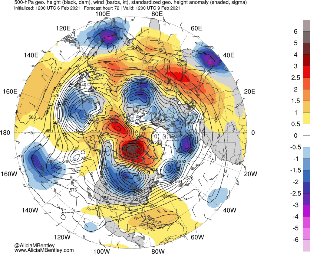
The two blocking orange/red high pressure features I noted above are both expected to remain present–in fact they should begin to merge into a single, large blocking feature. By Wednesday evening, the transformation should be complete.
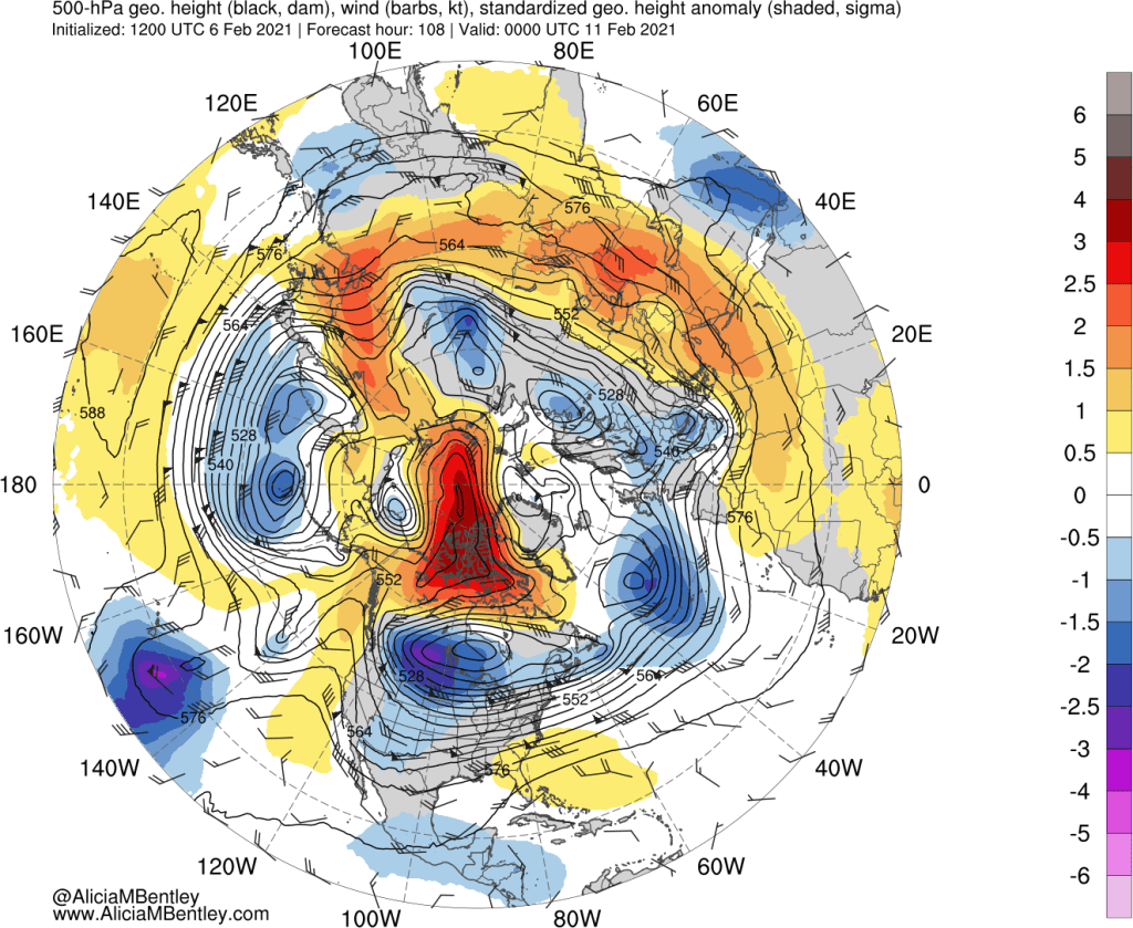
With zonal flow in the polar region completely blocked, the “polar vortex” and all of its associated cold air is expected to be pushed south into the US and southern Canada. The image below shows 850 hPa temperature anomalies at the same time as the previous image, Wednesday evening.
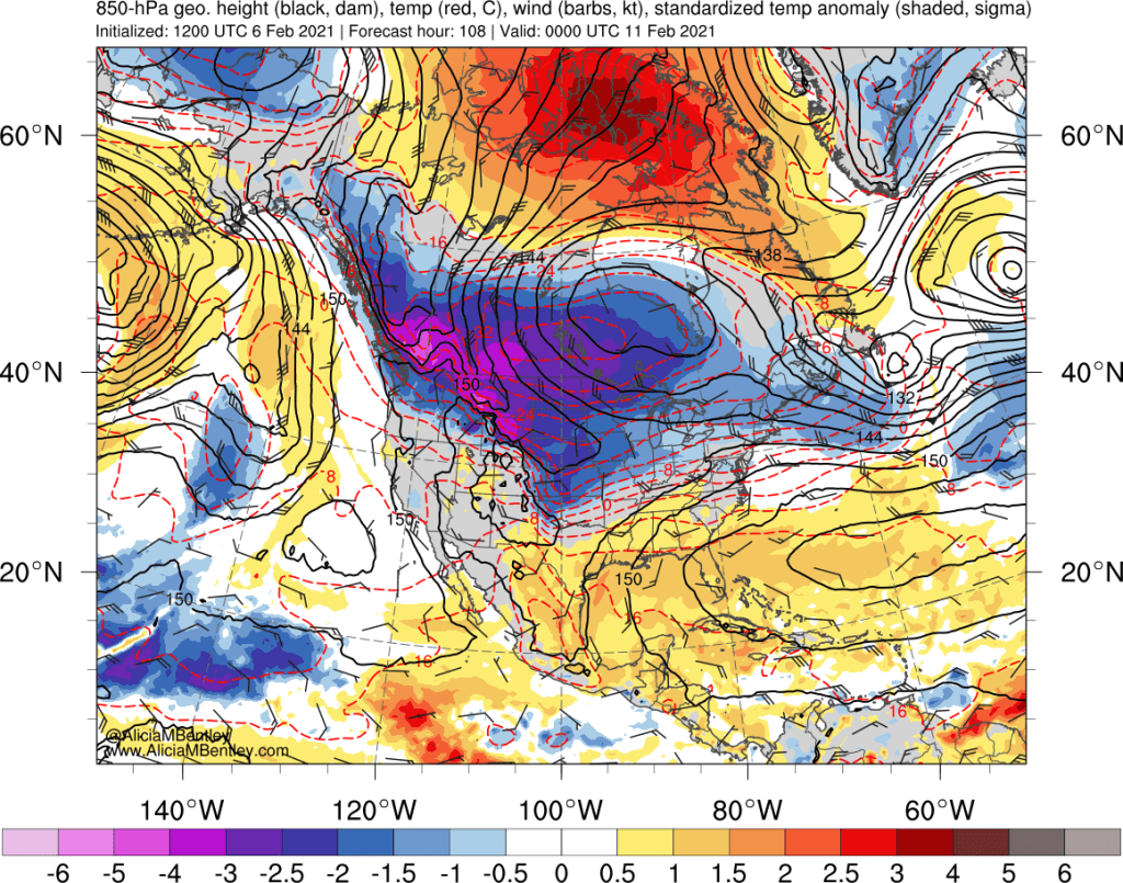
Arctic air will be right up against the Washington Cascades and BC Coast mountains. This cold air is extremely dense. Forecast mean sea-level pressure (MSLP) on Thursday morning is over 1060 hPa, or 31.3 inches of mercury.
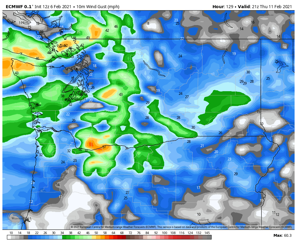
Even without a corresponding low pressure center offshore, there will still be a strong pressure gradient through the Fraser and Cascade gaps by Thursday. It’s a little early to speculate on wind speeds but a quick look at the ECMWF shows 40-50+ mph wind gusts will be possible.
Combined with cold temperatures (see next section), there is a potential for wind chills approaching 0 degrees F from Thursday into Friday in the cold/windy spots like Lynden, WA. Even Seattle could see wind chills in the teens, which is a dangerous situation for unhoused residents.
How cold will it get?
Next Friday-Saturday look like the coldest mornings. The latest ECMWF ensembles show a mean in the mid-20s for Sea-Tac airport on Friday and Saturday mornings.
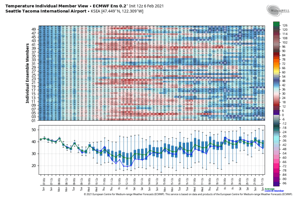
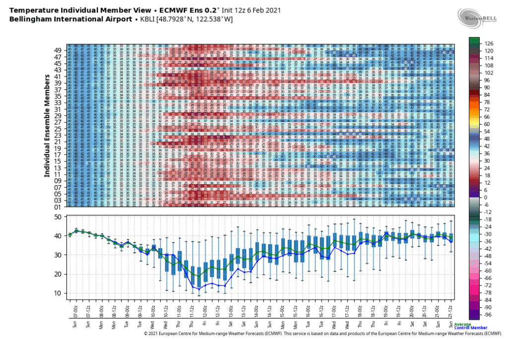
However, Sea-Tac is one of the warmer spots in the region. Bellingham will be even colder (and windier), with lows dipping around 20 on Friday morning (with wind gusts above 30 mph!). It will be hard to get colder than 20 unless there are a few inches of snow on the ground, which remains a slight but unlikely possibility.
For the real cold, just head east of the Cascades to Omak, where many ensemble members have temperatures below zero F.
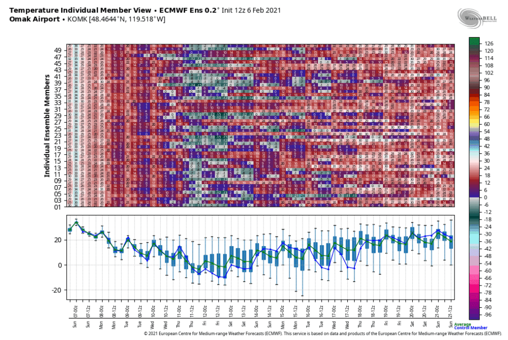
One might have noticed that all of the above ensemble plots still show a large amount of uncertainty in both the strength of the cold air as well as the duration. An arctic intrusion is looking likely with 80-90% probability. For duration, there is a 50/50 split with about half the members warming things up by the end of next weekend and the other half keeping the cold air around into the following week.
What about snow?
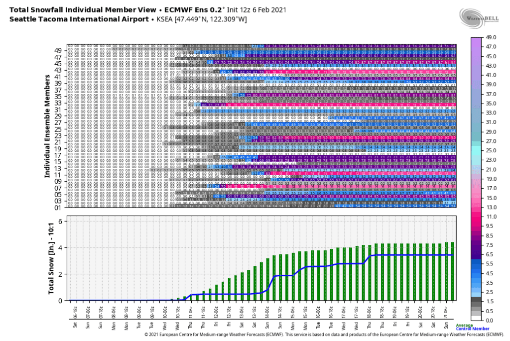
It would be a real waste of an impressive arctic air outbreak to not get any snow. The ECMWF ensemble mean for Seattle is 4 inches of snow, but there is a near 50/50 split on whether there will be just a few flakes or a decent snow event sometime late next week into next weekend. The GFS ensemble (not pictured) is a little more pessimistic with about 1/3 of members showing widespread accumulating snowfall.
The pathway for measurable snow is interesting and somewhat unusual. Given the strength of the high pressure ridge along and offshore of British Columbia, there is no pathway for a weather system to ride over the ridge and drop down from the northwest.
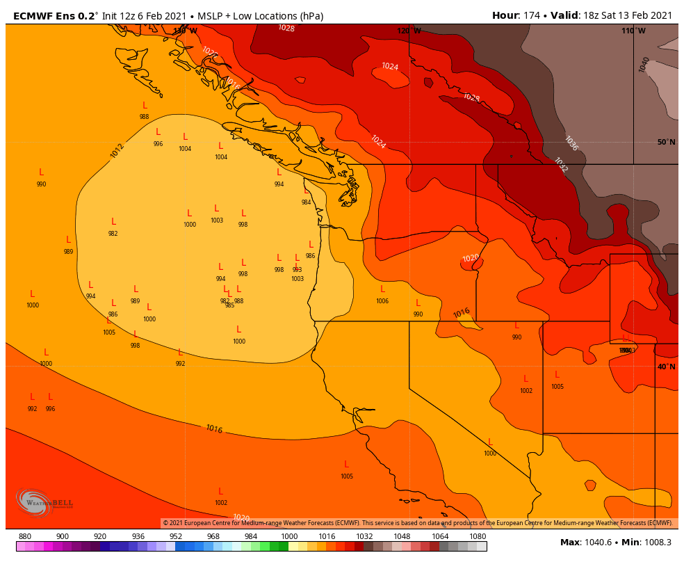
However, a few weather systems might make an attempt at approaching from underneath the ridge, straight from the west or west-northwest. There’s no point in going into details at this time since the ensembles are all over the place. For instance, the ECMWF ensemble ‘low locations’ plot suggests the possibility of a low pressure system approaching the PNW next Saturday, but no consensus or even clustering of a preferred track.
Given the likely extent of the cold air and the general indication of active weather approaching next weekend, I would be surprised if the coastal PNW gets out of this period without at least a little bit of lowland snow.
